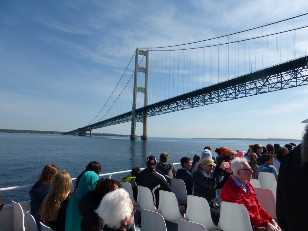
No matter how you spell it, it’s pronounced mack-in-aw. The anomaly
has something to do with the French influence of a silent “c” at the end of the
word, the desire to give the island (Mackinac) and the nearby mainland city
(Mackinaw City) distinct identities and postal addresses, and the natural
inclination of those in civic power to name things in ways that drive proofreaders mad. (It could
worse: the 17th-century word for the area was Michilimackinac.)
Imagine for a moment that you’re transported by high-speed passenger ferry
to a place where cars, trucks, and motorcycles do not exist. A place where the
only motor vehicles allowed are some emergency and service vehicles, plus snowmobiles during winter. A place where community, business,
and tourism must carry on as in any other locale, only through a peculiar blend of multi-century construction, commerce, and anachronistic transportation
technologies. You have come to Mackinac Island, Michigan.
 |
| All of Mackinac Island is a National
Historic Landmark, and more than 80% of it is a state park (formerly a national
park). The parts that aren’t park are businesses and residential, mostly on the
south/southwest/southeast shores and on a narrow swath leading from the docks
to the middle of the island. It is only 8 miles in circumference, with many
roads and forest trails winding through its center. Max elevation is about 320
feet above Lake Huron. |
Close your eyes and listen as you walk this island. It is
alive with sounds both rare and common. In town, there’s the continuous jangle
of harness and the heavy clopping of draft horses hauling drays or pulling carriages
and trolleys full of tourists. The shriek of schoolchildren romping through city parks or racing
each other up the fort road. The shush of bike tires coming up from behind you.
The sharp
trrr-ring of a bicycle bell
warning you to move aside as a hotel steward steers his luggage-laden bike from
dock to B&B. The general hubbub of people shopping for fudge, lunch, a
horse-drawn taxi, souvenirs.
On side streets, the bass whurrvvvvve of a lawnmower plays a duet with the bzzzz-eeeee whine of a weed whacker. The
rhythmic scratch-scritch-scratch of a
paint scraper flakes years of history from a shore-side home. A rib-throbbing booooom of cannon thrills from a
military demonstration at the island’s fort, and the ratta-tat of air nailguns drifts in from a distant construction
site.
In the island’s interior, the speeches of microphoned tour
guides bounce from tree-lined roads, joined by a chorus of whistles, tweets,
and chirrups of birds unseen in leafy trees. Deeper in, you hear the
penetrating quiet of trees and mushrooms growing. Ahead, huffs and
puffs warn of bicyclists topping a hill. From somewhere far off, bizarre
drumbeats tattoo through the woods as if from a Native American circle—a
mystery that resolves itself into a boy scout troop gathered in ceremony at a
cemetery. At a tour rest stop, horses slurp water from troughs as their tourist cargo, offloaded, revels over nearby views.
These, and more, are the sounds of Mackinac Island, a place as modern
as any other Internet-wired city, but deliberately kept in a pre-motorized era
to support its tourist economy and the quieter, more communal environment its 500
full-time residents prefer.
 |
| The most visitor-focused Mackinac businesses crowd
the ferry dock—bicycle rentals, carriage tours, and the façade of Main Street, with
building styles that run from Victorian to Cape Cod. |
 |
| Bikes, horse-drawn wagons, and inviting
spic-and-span street fronts. |
 |
| A wagon heads to the docks to collect cargo. When
our ferry pulled in, the dock was stacked with bales of hay—even horse feed
must be imported. Outfitting a home or business here is like outfitting a college
dorm, but on steroids: start from scratch and haul everything to the island,
from construction materials to furniture to houseplants to pet food. The yellow
building at the left is the taxi service…horse-drawn of course. |
 |
| A dray waits at the wharf. |
 |
| Crossing the street means watching all
directions for unexpected kinds of traffic. Bikes and carts are often the
swiftest methods of conveyance. We didn’t see a lot of overweight workers,
except those who drove the carriages and tour trolleys all day long. |
 |
| Bellhops on bicycles make short work of luggage
hauls. Most hotels and B&Bs are within a few blocks of the dock. Those
deeper in the interior require horse taxis to get to. |
 |
| Things begin to seem surreal as the concept
of “no cars” sinks in. |
 |
| An impending traffic jam at a street corner. |
 |
| Package delivery on Mackinac. One guy drives
while another runs the parcels. |
 |
| With horses come cleanup crews. Mackinac is as
fanatical as Disneyland for keeping its streets and image clean and tidy. Subsisting
mainly on tourism, the island quickly feels like a bizarre joint venture
between a commercial amusement park, an historical interpretive committee, and a
forestry service. Somehow it works. |
 |
| Squid people were rampant. Today was a school
tour day, and we shared the morning ferry with four busloads of grade-school
kids. Imagine our delight. Most of them charged off to the historic fort or the
fudge houses immediately upon landing, and the island is large enough to absorb
their count without feeling crowded. Mackinac averages 15,000 visitors a day in
the high season. We seemed to be early, and the crowds were thin
overall. |
 |
| One of the many fudge shops on the main drag. I
partook of this company’s offerings and came away with three flavors of smooth,
sweet indulgence—toffee chocolate, Kahlua chocolate, and peanut butter chocolate.
Half is still in my freezer. |
 |
| It’s not Ripley’s Believe It Or Not (yet), but
there are a few funhouses to be had on the island’s main street. I took this pic
because the dark glass of the still-unopened shop reflected Ken and me like a
mirror—a play on the business itself. |
 |
| Hotels and B&Bs a block off the main street.
Also nearby are a visitor center/museum and the governor’s mansion (with tours). |
 |
| The island has a long history of use and occupation—from
Native Americans (Chippewa, Huron, Ojibwe, Ottawa, and
other tribes) to missionaries to military outposts to a wealthy society’s summer
playground. This birchbark chapel is a replica of one built by the Jesuits (Catholic)
in 1699 and felt quite cozy inside. Fort Mackinac is that white building beyond
it. |
 |
| A more contemporary style of church, Trinity Episcopal,
built in 1882. |
 |
| Touring Fort Mackinac gives a historical view
of life on the island from the 1780s through the 1800s. The experience includes
interpreters dressed in period costume, daily cannon and musket demos, and
restored military buildings, hospital, schoolhouse, etc. Having just been to
Fort Niagara, we chose to skip this one. |
 |
| Three-horse trolleys are used for large group
tours through the center of the island. It has more hills and requires the horsepower.
Our pedestrian wanderings had us following one of the trolleys downhill for a
while, and we eavesdropped on interesting statistics, such as the fact that draft
horses can pull four times their body weight, or about 6,000-8,000 pounds each. A trio’s combined capacity is easily beyond the weight of a fully loaded trolley, even if the thing lost its brake-assist downhill. |
 |
| One of the island’s more distinctive natural
features: Arch Rock, a rare phenomenon in limestone deposits. Easily dissolved,
limestone usually collapses before an arch can be formed. |
 |
| From above Arch Rock, the
water of Lake Huron looks almost tropical. |
 |
| Tours stop at Arch Rock, where
horses are watered and rested. This two-horse surrey accommodates more intimate groups. |
 |
| Tending the thirsty. |
 |
| On the southeast side of the island, view of
Lake Huron, the Mission Point Resort, and Round Island. |
 |
| One of the homes with that view. Many people
have seasonal residences here. We paused to talk with a woman working her front
garden. She and her husband had recently returned for their summer stay. He
came up the hill riding a bicycle (of course) and promptly offered us banana
bread he had just bought in town. We hung around and chatted for well on twenty minutes. They be good folks in Mackinac. |
 |
| Loved how this house’s shutters match the color
of its tree. |
 |
| Daily life of the “real” island people. Most
workers are imports for the summer, with nationalities representing a wide
world. This fellow spoke almost no English and seemed to be from a Slavic country.
He had just started the laborious project of hand-scraping paint from this very
large home. The junk-filled cart in front of Ken is a rental dray. Companies
haul them in by horse, unhitch and leave the cart, then come back for it when
it’s full. |
 |
| Tulips and bleeding heart in a private
garden. |
 |
| The signs read: “Mackinac Porch Rules: Sip iced tea. Watch the
Waves. Laugh.” |
 |
| Undoubtedly the island’s most famous attraction
is the Grand Hotel. Built in 1886 by a railroad and shipping conglomerate to
take advantage of the popularity of the newly created Mackinac National Park,
it put Mackinac on the map as a getaway destination for the well to do ($3 to
$4 a night). Its main claim to fame is the world’s longest porch—200 feet of
frontage that has served as promenade for hundreds of celebrities from Mark
Twain and Thomas Edison to Bill Clinton and Vladimir Putin. Today the rates start
at $289 per person per night, which includes breakfast, lunch, and dinner (yes,
about $600/couple per day for a Category 1, non-view interior double room). According
to this sign, “gentlemen after 6
p.m. must be attired in coat and tie. ladies
may not be attired in slacks.” Only registered guests are allowed into the
hotel. Non-guests must pay $10 to enter the lobby and enjoy the porch. Young
brown-skinned ladies (foreign imports) dressed in long skirts, airy blouses, and floppy sunhats were
posted just beyond this sign to kindly turn away unqualified visitors and looky-loos
like us—genteel bouncers of another era. |
 |
| Front of Grand Hotel, as close as we riff-raff could get to its famous porch. |
 |
| Topiary on the grounds. |
 |
| The living version takes hotel guests to and
from town. |
 |
| Entrance to the Jockey Club restaurant, part of the Grand
Hotel grounds. I half-expected Mary Poppins and Bert to come dancing out with penguins. |
 |
| Everything here is moved by horse drays…even empty carriages. This fancy number is probably
a favorite for weddings and other romantic events. |
 |
| These folks rented a one-horse, drive-your-own surrey. Rentals travel on quieter roads where they won’t meet up with the
larger tour trolleys. Saddle horses are also for rent, for riding through the
forest roads of the park. |
 |
| Our wanderings took us into the heart of the
island, where most of the full-time islanders (i.e., full-time employees) live.
As everywhere else, only horses, bicycles, roller blades, or feet are used for
getting around and carrying out municipal chores. This team is the recycling pickup crew, going house to house and collecting bags left at the street.
One lovely neighborhood characteristic that we noted: having no cars means having no
garages to overwhelm properties or home designs. |
 |
| Residential Mackinac. |
 |
| The startlingly down-home Mackinac Island
Police Department on the same street. There’s also a police department in town, so we suspect this
is a satellite office. |
 |
| OK, this one did surprise us. We had been
wondering how they kept all the interior roads clear of poop, especially with
so many triple-horse trolleys traveling them. The solution? A horse-drawn
motorized street sweeper. These two horses even clean up after themselves! |
 |
| Walking the woods in the center of the island.
Forest paths criss-cross for local shortcuts, wooded walks, and horseback day
rides. |
 |
| Trillium on the forest floor. |
 |
| These shelf mushrooms reminded me of buckwheat
pancakes. |
 |
| View from the top of the island, at Fort
Holmes. |
 |
| That’s the Mackinac Bridge discussed in the previous blog. Way zoomed in! |
 |
| A ferry passes the lighthouse to bring its next
group of visitors and residents to the island. The lilacs in the foreground
were blooming just in time for the island’s upcoming annual Lilac Festival. |
 |
| Another view into town, this from the road that winds around the west side of the fort at the end of our walk. |