A shower and some moving around have helped a little this morning. It’s 6:30 now. Breakfast is at 7:30 and I’ve got a glorious hour of lazing around in bed now that I’m dressed. I’ll pack my toes and my bag after breakfast to be on my way by 8:30.
Having walked or fell-climbed an average of nine miles for each of four days, I’m at that in-between stage of wanting to rest (or quit) and feeling dejected over yet another two more days of Lake District hills. My body will hold up, but I’m definitely pushing its limits.
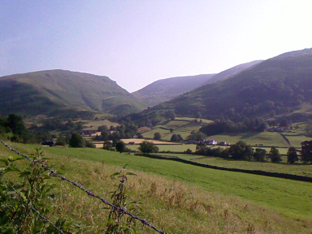 Last night Barry pointed me to an alternative path out of Grasmere that goes around a lump of land called the Great Tongue, which rises, well, like a big green tongue between two hills and gills (Little Tongue Gill and Tongue Gill—sometimes these place names make ridiculously simple sense). The trail to the right, Tongue Gill, has a gentler climb than the “official” trail to the left, and I have no hesitation in taking it this morning.
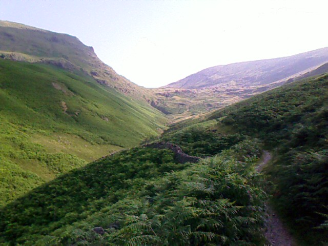 The day is bright and the walk easy over several stream crossings and through waist-high fern along the south side of Great Tongue. A few sheep are around. They run away from me, crashing through fern in startled, bleating leaps. I’m otherwise alone on the trail, although I can see two people, not necessarily traveling together, a ways behind me.
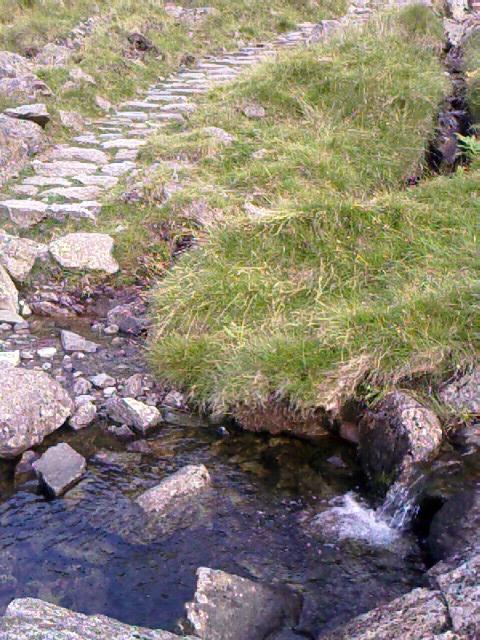
 At quarter to ten, I’ve nearly reached the top of Great Tongue, and I take a break where the gill runs cold and clear over rocks and creating a small pool. I soak my kerchief and drink in the view of Grasmere in the valley below the deep fern green of the Tongue. I’m in the middle of making a voice recording about my progress when a familiar white hat and face come over the rise—it’s Michael, with David shortly behind.
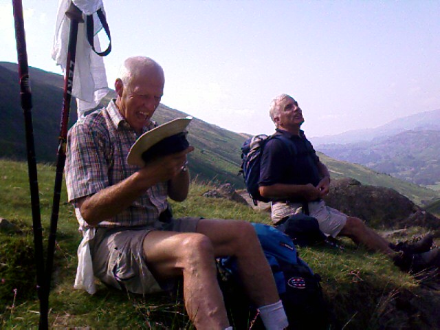 “We thought that was you ahead of us!” says Michael as he sits down and stabs his trekking poles into the ground. “Those legs were like a carrot on a stick, leading us on!”
I am grinning, happy to see them both. David’s holding up well. We take a break together, sharing perspectives on yesterday’s walk. They had taken the low road through the valley to Grasmere.
“Awful, just awful,” says David. Michael agrees. It was more of the same rocky, rough terrain we’d covered the day before, plus it was hot and there was not much to look at.
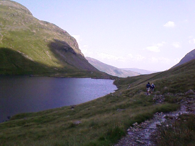
A little after ten, we strike off together to the top of the Great Tongue, where I pause to take one last look back at Grasmere to say good-bye. The trail levels off a bit, then heads down to Grisedale Tarn (a small lake) where I yelp again with delight—there are John and Elaine, the couple from Australia.
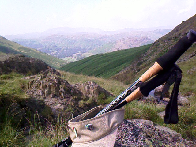
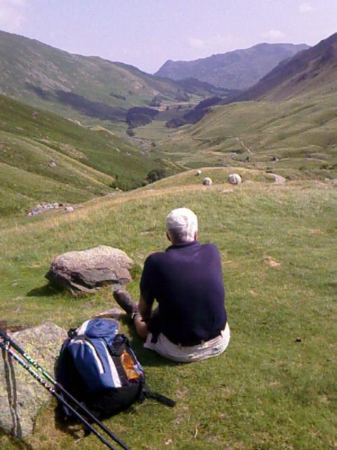
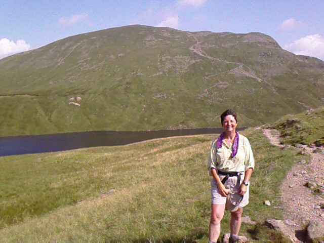 We all make introductions and discover that John and Elaine are tackling a grueling string of hills that starts with a 1,000 foot climb to Dollywaggon Pike (I call it Dolly Parton Hill—that’s it behind me in the photo), goes another 1,000+ foot climb to the top of Helvellyn (3,118 feet), and culminates with a walk along the infamous Striding Edge, a popular, dangerous, wind-blown path that’s barely a few feet wide and has sheer drops of 2,000 feet on either side. (This is a two-way path, mind you, with people laden with backpacks trying to pass each other.) Their night’s lodging is on the other side of the ridge.
Michael, David, and I are all staying in Patterdale—they at a campsite, and I at a B&B that I hope is near the center of town. We’ve got three choices for route from where we stand at Grisedale Tarn: the same ever-uphill, harrowing track that John and Elaine will be taking to the left (no, thank you!); another ridge walk to the right along a saner-looking, long fell called St Sunday Crag (uh, think I’ll pass on that one, too); and a relatively straight shot down the valley of both ridges, following Grisedale Beck (stream).
 Wainwright prefers, of course, a ridge walk, and recommends the less crowded St Sunday Crag, but all three of us opt for the direct valley route as quicker and easier on our bodies. We wave good luck to John and Elaine as they head for the trail up the side of Dollywaggon Pike, and I walk the rest of the day with Michael and David.
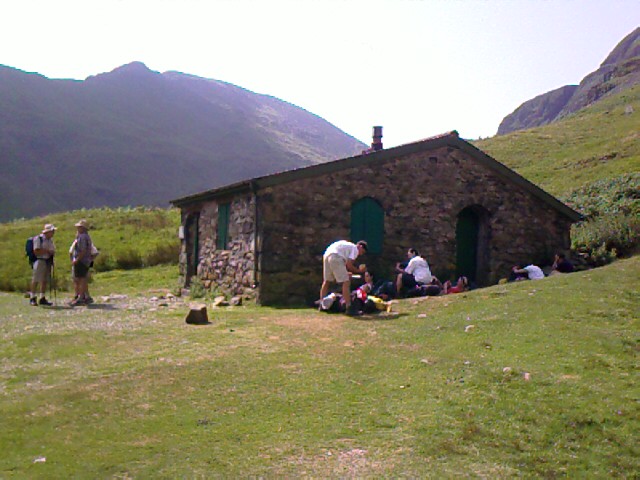
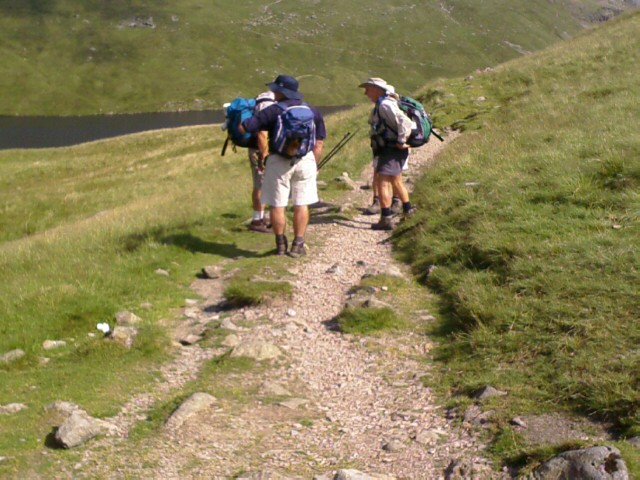
 We eat our sack lunches at 11:30 at Ruthwaite Lodge, a former rest stop for travelers that’s now a locked clubhouse for a mountaineers group. By the time we reach it, every square foot of shade around the stone building is taken up by other trekkers and their packs. We park ourselves on a grassy knoll to rest, eat, and enjoy the stretch of valley ahead.
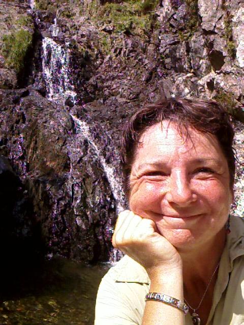 A beautiful waterfall is tucked away beyond the lodge, with a small pool. I hike down to it. Skinny dipping would have been lovely here. There’s also a cave entrance, probably left over from mining. I go into the tunnel about 150 feet, and it gets dark real fast. Lots of water is on the ground. Without a flashlight, I retreat quickly.
Wainwright laments that this part of the Lake District is heavily trafficked—Helvellyn is purportedly the most frequently climbed hill in all of England—and it is here that I begin to see many more people traveling the trail in both directions. Some jounce by on mountain bikes. Most are on foot carrying packs. I saw a few tents set up at the tarn.
Michael points out a faint, unending line of walkers coming down a footpath from Striding Edge to Patterdale on this side of the ridge. “The bus people,” he calls them, referring to how they get dropped off by tour bus at trailheads and travel in packs on their way down.
The walk today is gentle and easy, but without shade until the end of the valley. I’ve had too much sun again, and I start to feel headachy and nauseous once we reach a farm road. David goes ahead and Michael stays with me while I rest at the roadside and down the rest of my water. I make a mental note to buy aspirin to carry with me.
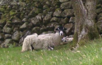 Nearly to Patterdale, we come upon a sheep and a lamb that’s barely larger than a small dog. It’s a very late birth, considering they’re usually born in spring. All the other lambs I’ve seen are nearly two-thirds the size of their mums, round and puffy with new wool. This one looks barely old enough to stand.
We pull into Patterdale at half past one and sit at an umbrella’ed table outside the Patterdale Hotel for a cool drink—J2O orange-cranberry for me, beer for Michael and David. We look over tomorrow’s plans. There’s one more steady, heavy-duty haul uphill to reach a ridge walk that passes The Knott and goes to Kidsty Pike. Michael has never done Kidsty Pike and is looking forward to putting a tick mark next to it on his list of places he has trekked in the UK. From that high point, there’s a pretty severe-looking descent to Haweswater Reservoir, for a four-mile waterside walk before we go several more miles to our respective towns for the night.
Michael and David are staying overnight tomorrow at Shap, I think, which is directly on the trail. I’m headed for Bampton Grange, which turns out to be farther off the C2C trail than I expected—so far, in fact, that it’s not even on the Footprint map. Thank god I bought the OS map that can get me there.
I’m disappointed that tonight’s B&B, Greenbank Farm, is also almost two miles beyond Patterdale’s town center, and therefore two miles away from where the C2C trail picks up near Michael and David’s campsite tomorrow morning. We say our goodbyes for the day and agree to look for each other tomorrow.
En route to Greenbank Farm, I stop at the post office/general store for aspirin, bandaids, and electrolyte drink for tomorrow. After today’s trek, I plan to carry three liters of fluids instead of two.
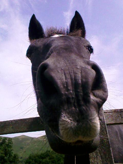 I am greeted by a lovely black horse on the way to the farm—he nickers and comes up for nose pets. I give him the apple left over from my packed lunch.
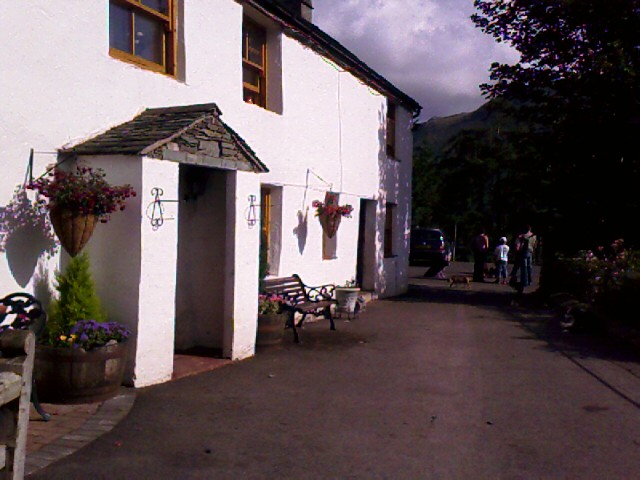
Greenbank Farm is very welcoming, and I immediately note it as the best lodging, alongside Low Cock How farm, that I’ve come to so far. Beverley, the proprietress, is talkative, friendly, and helpful. She’s walked the fells and knows their many trails, and begins telling me of alternative routes to Bampton Grange. I’m too brain-weary to take in the details, but I grasp that there’s a way back to the C2C path that doesn’t require me to return through Patterdale. And that she recommends taking something called High Street instead of going along Haweswater Reservoir.
It’s nearly 3:30p, and I’m feeling very tired. I sprawl out in my upstairs room with the window open. Wool is burning outside in the farm yard—the leftovers from shearing. It smells like burning meat and burning hair at the same time, both pleasant and unpleasant. Sheep are bleating and baaing in an incessant chorus. Two young neighbor boys are playing in the yard, romping here while their mums are on errands in town. They’re laughing and traveling around in a plastic-wheeled cart of some kind—it makes that grindy sound of plastic rolling on gravel. The farm’s many hounds are hot; I can hear their panting from up here. I fall asleep for a much-needed nap.
 I am the only guest for dinner tonight, and Beverley serves me an absolutely huge and luscious meal of melt-in-your-mouth beef slices, whole fat baby carrots, and small whole white potatoes, steamed broccoli, followed by hot apple pie wallowing in cream. I could have second and third helpings on that dessert, were I not so full.
After dinner, I retire to my room to study tomorrow’s maps and try to remember what Beverley has told me. If I keep going south to join the C2C path, instead of doubling-back north to Patterdale, I estimate that, right now, I’m roughly in line with mile 48 of the official trail. I can see the top of that ridge walk straight across from my bedroom window.
Beverley has suggested that I go south through Hartsop, follow Hayeswater Gill (stream) to Hayes Water (a small lake), and then go up one steep hill to meet the C2C trail shortly before The Knott.
“It’s an easier trail than going all the way back through Patterdale and around the top,” she had said. “And don’t take Haweswater Reservoir from Kidsty Pike, either. It’s as bad as that road along Ennerdale—rocky and hard to walk. You’ll want to go down High Street, the old Roman road that goes along the ridge, to Bampton Common. It will lead you straight down to Bampton Grange for the night. Just be sure not to miss the turnoff onto the High Road after The Knott.”
Nine to ten puppies are playing in the garden. Their yapping antics pull me away from my maps, and I delight in watching their energetic pounces and tumbles. Three of them play a game of tug-of-war with a frayed rope, and one growls over the possession of an empty plastic garden pot. One of the mom-dogs overlooks it all; occasionally an uncle or aunt dog joins in. There are two sets of pups—wire-haired border terriers and Rottweiler-looking Australian herding dogs in black and chocolate versions. I didn’t catch the breed when Beverley’s husband told me. They’re bred here. All for sale. There seem to be twenty dogs all told, adults and pups included.
Returning from the window, I fold up the maps and name some photos from the last two days before going to bed. I need to do that daily, else things become a blur. Even the coast of St Bees feels weeks away, and it was only Tuesday, five days ago.
Trail miles: 10.5; actual miles walked: 10.5