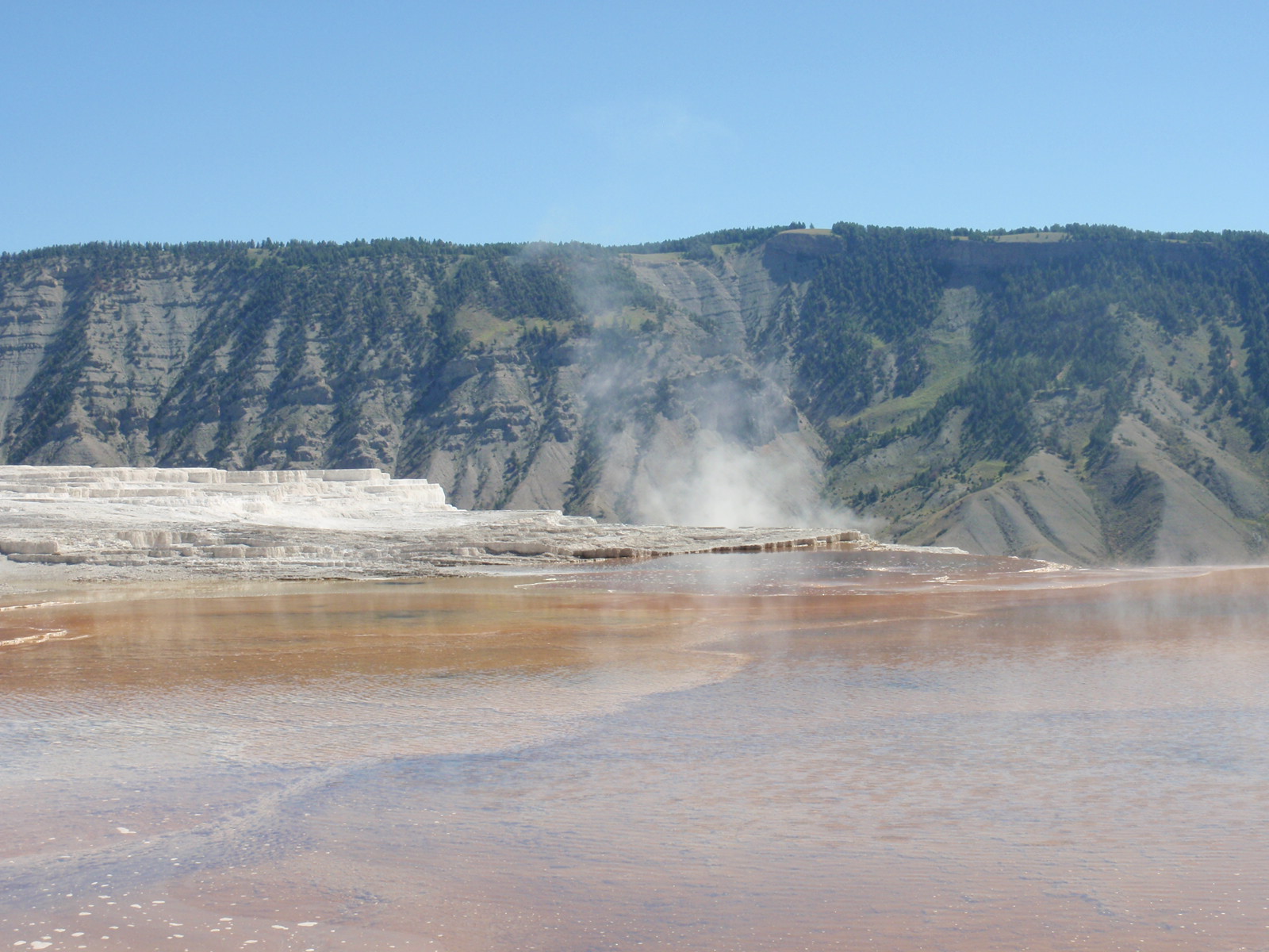
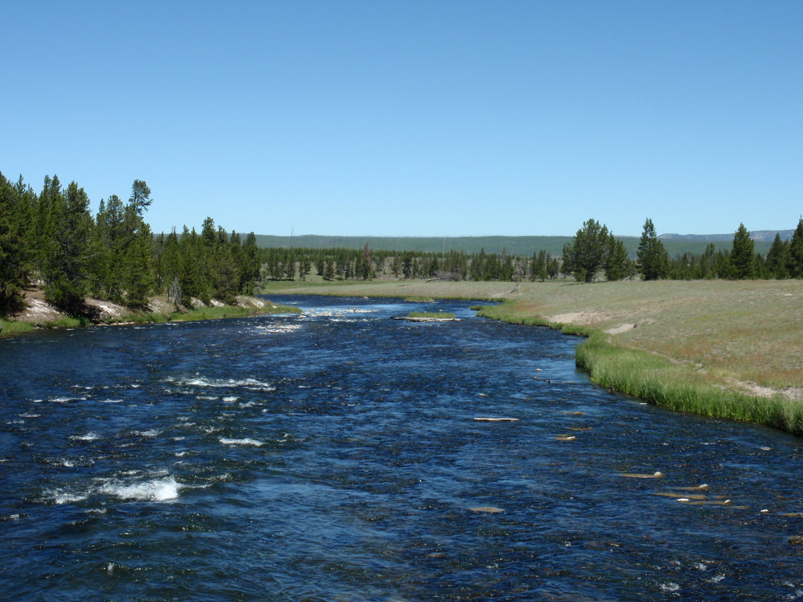
Well, after almost 50 years of living in the west/pacific northwest, I've finally made it to Yellowstone National Park! This is another place that Ken has frequented often, having worked here for two summers as a volunteer and visited every year for the past 40 or so.
We came in from Montana, via the West Yellowstone entrance. This park is so big that it's got five ways in, and only a fraction of its 2.1 million acres is actually roaded and accessible for viewing by John Q. Public without backcountry camping among bears and mosquitoes.
We spent two weeks here, one week at an electric-only site at Baker's Hole in West Yellowstone outside the park, and another week at Mammoth campground, inside the park at the northern border. None of the in-park campgrounds have hookups, but the park was mobbed with tourists...more crowded than Ken has ever seen it. The campgrounds were all full by midday, and the few that would take reservations were booked weeks in advance. Non-reservation campgrounds are catch as catch can--you show up and hope something's open that will also fit your rig, then you can stay for up to 14 days without worry.
The day we moved to Mammoth we arrived too late for a site--it was full by 1:00 when Ken was used to seeing it fill by 3:00. We left the park and ended up at a forest service canyon campground nearly 20 miles away that night, barely getting a site there, either, for its being full and mostly suited for tents, not 28-foot rigs. The next morning we got a great spot at Mammoth that enabled us to fill fresh water from a nearby spigot and dump gray tanks by the bucketful at a nearby toilet. It was almost as good as full hookups, just less convenient.
For ease of management and touring, Yellowstone is divided into five "countries"--regions that have their own unique geological and wildlife features. Miles of loop roads link the countries, and rivers run through all of them. We visited all five countries, with the least time spent in the Lake area because we didn't go to the extreme southeast corner of the park (not much to see according to Ken, and comprising two roads that lead out of the park instead of through the area). I've given each of the other four countries its own photo essay here in the blog: Geyser, Mammoth, Canyon, and Roosevelt. You may want to read them in that order.
Geyser Country is quintessential Yellowstone--home of Old Faithful; holes and pools spewing vapor, water, and mud; and steaming springs lined with jewel-like colors. Contrary to what I expected, a lot of the region is actually rolling hills, meadow, and burned-out but recovering forest (from a devastating fire in 1988), dotted with bald spots of gray and white where the underlying volcano still actively boils water and generates associated geologic features. The area is particularly spectacular in the cool of the morning, when steam vents are most visible.
Touring Geyser Country is an exercise in driving from one viewpoint to another, finding a parking spot, walking boardwalks that extend far out over some of the geyser fields, and jostling for photos at the many points of interest. Busloads of Asians, rented motorhomes of Germans and French, motorcycle groups of big mamas and leather-chapped men, and cars and vans stuffed with families and touting plates from all across the US...it's summer in Yellowstone.
Most of the days that we toured and hiked were clear, warm, and sunny, making for some stunning color displays at several of the pools, flows, and springs. Most colors are created by heat-loving microbes living at varying temperatures, although a few are formed by minerals like sulfur (pale yellow) and calcium (white), and some by acids breaking down the soils (gray and browns).

Emerald Pool.

Sapphire Pool. This sure looks like something you could take a cool dip into, but it's no Caribbean sea or backyard pool. People have died from severe burns by falling into these things.

Clepsydra Geyser. This is a high-sulfur geyser (note all the yellow buildup), and steam would blow our way, bringing the smell of rotten eggs. The kids around us were all "ewww"-ing and "gross"-ing and holding their noses.

Clepsydra Geyser (background) and Spasm Geyser (foreground). Both were very active and entertaining to watch. Spasm Geyser was aptly named--its action was definitely spastic.

Grand Prismatic Spring. This was by far the largest and prettiest of the springs--the reflected colors of the water actually turned the steam into shifting fogs of pink and blue. By the time we got through this area of Geyser Country, we were smelling very much like wild water--sulfurous and mineral-laden from clothing to hair.

Cliff Geyser. This one blows and goes quiet on quick intervals, about ten minutes apart, so it was fun to catch on film. I loved the color combinations of this area--water, rock, grass, steam. The orange flows are from hot water slithering down the microbe-covered rocks into the river. I touched one of the orange streams in a different area of the park; it was as hot as water scalding from a tap--not something you'd be safe dipping into. There are two parts of the park rivers where people can swim and soak in spring-warmed water, though. We partook of that near the Mammoth campground one warm afternoon, and came out smelling like minerals all over again.

This spouter has built up a termite-hill-looking pile of minerals over the centuries. We're in the Great Fountain area, but this is the geyser that blew off while we were there. Funny how you can just miss a blow-out by seconds, or catch one just in time. Great Fountain has amphitheater seating to watch its display, but a four-hour window for watching its next showing. We didn't stay for it.

Painted Pots, one of the acidic pools that bubbles mud. A great stench of sulfur here.

Painted Pots, up close. The sound was like a stew pot boiling on the stove.

Sunset Pool. This pool had the most steam blowing of those we visited that day. Standing near it was warm as a sauna one moment, cool as an ocean breeze the next as the winds shifted and played the steam.

A river running through the Grand Prismatic Spring area.

Old Faithful, with a few hundred people waiting for her to blow at 2:10.

She finally goes off at 2:27 and spouts for about 2 minutes. Next showing: 90 minutes later, give or take ten minutes either way. (For a live webcam of her activity, go to http://www.nps.gov/archive/yell/oldfaithfulcam.htm; you can also watch videos of previous blows on YouTube.)

Fairy Falls, on a hike in Geyser Country.


A lot of Yellowstone looks like this today--the 1988 fire left stalks of burned tree trunks, now grayed and weathered and falling over, with new growth of 20-year-old evergreens beginning to fill in.

On hikes you can pass hot streams and geysers that you can get close to without boardwalks.

Spray Geyser put on an active show, going quiet for only 20 seconds at a time.

These dry-cracked fumaroles (steam vents) were so weird next to the colorful wet of the geyser. The ground here sounded like boiling eggs bumping in a saucepan--air pockets and water activity beneath the earth kept me laughing with its burping sounds.


Another angle on Spray Geyser, in one of its still moments. The sandpit in the foreground is a bison wallow. This area had lots of them.

Seen from the hill the to north of the geyser.

Two ponds at the top of the hills, almost covered in lily pads.

I think these are Indian Paintbrush; they were prevalent.

Fairy Falls seen from a distance on the hike. Much of the meadow has become treed now after the fire.

A bison near the trail we will ultimately take back. We were a little worried that he was wandering so close to it, but at this point we are a mile away.

He was indeed still there when we arrived, but had moved farther from the trail and into a bit of woods where I could get this telephoto shot. We met a couple of other hikers who had also seen him, and perhaps annoyed him by hanging around longer than they were welcome. Ken had us move very wide around him because he was lifting and shaking his head toward us in classic "get out of here or else" bison language. Two days earlier, a bison had charged a woman in Yellowstone, and we weren't taking any chances. (For some interesting footage, look up "bison attacks yellowstone" on YouTube. People can be really stupid in provoking these big boys.)
 All artists love Lower Falls, here seen from a north rim pullout. There are also lots of viewing places down near the head (brink) of the falls along a winding trail down. The south side of the canyon offers its own views, some with boardwalk steps that cling to the side of the canyon.
 Yellowstone Canyon, as seen from the brink of Lower Falls. The sun that day was glorious.
 A bison jam in Hayden Valley: traffic is stopped for two miles in both directions.
 Bison were meandering across the road toward grazing lands along the river. They do this a lot--back and forth throughout the day.
 Although it ultimately took us 40 minutes to get past the moving blockade, it was hard to get irritated at the delay...I'd rather stop for bison than for 5 0'clock traffic any day.
 Two babies. The caramel-brown one is younger, a later arrival that may have trouble in the winter if it doesn't get really strong really soon.
 No worries for this crowd even with cars piling up on the road. The dust cloud is from a bison rolling in a wallow.
 This pair forced us to a halt by walking directly in front of our truck--and stopping! Note the size difference of the male (back) and the female (front). She looked straight at us as they paused for a bit, then they slowly moved on as if hitched together. Those two people up ahead are park employees. They show up at heavy traffic stoppages to make sure animals like bison and bears aren't harassed by photo-hungry tourists and that no one is injured; they don't do much to hurry or guide the animals along. Critters run the show in Yellowstone.
 The pair paused and looked at us again near the other side of the road. Still no moving for our truck until they were completely off the pavement...with the male's butt within scritching distance through my window (no, I didn't).
 The bison seemed to enjoy walk into traffic and stopping. This one held up the line for several minutes. Another stood in front of a motorhome for more than ten minutes before it decided to move on. Generally neither lane of traffic could move, because a bison is just as likely to turn around and go back as to continue the way it is facing. A little later another one stopped in the road because its right forefoot was sore...it held it up gingerly and finally limped away and paused again just a short distance from the road for another rest.
 Canyon Country has its own set of hot springs and fumaroles with interesting names like Mud Volcano and Sour Spring. This is Dragon's Mouth, a wonderfully noisy and active spring that spits water through the opening in belching, steaming waves. The entire area is highly sulfurous, making a great stench as well.
 Bison own the land...even along a walk that thousands of people use to reach other springs in the area. This one just hung around his wallow, chewing cud and flicking dust onto his back with his tail.
 I could have been at a zoo taking his photo, except that there's no fence between us. Thank goodness for zooms.
 Churning Caldron [sic], one of the many appropriately named hot springs in this area. This spring was really fun to watch--it boiled up incessantly like some soup gone mad.
 Sulfur Spring, one of the world's most acidic bodies of water. It's pH is like battery acid. The gorgeous hills in the backdrop are at the edge of Yellowstone's famous caldera--volcanic crater--that extends for miles. That hill there is actually still rising and falling like an inflating and deflating balloon because of the volcanic action that continues beneath Yellowstone.
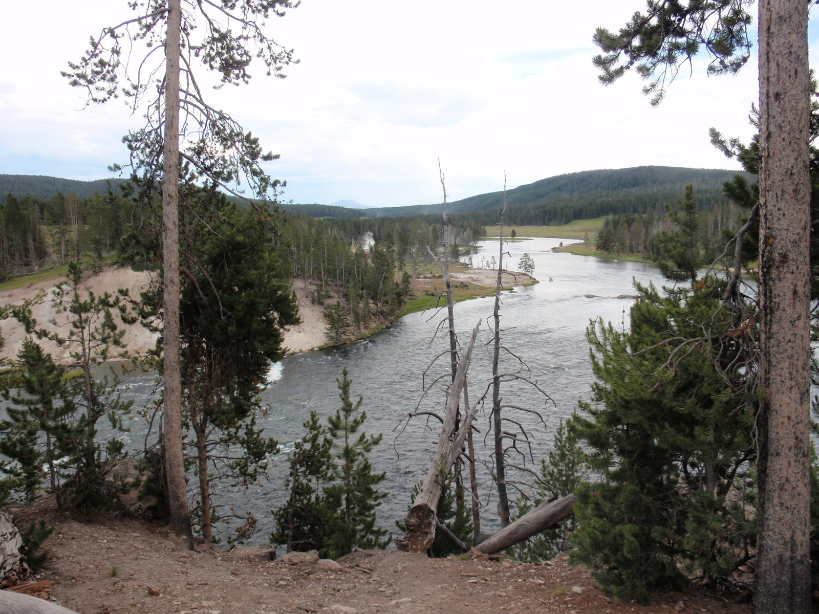 Another view of the Yellowstone River. Beyond the falls, it's generally shallow, wide, and quiet, with very few rapids.