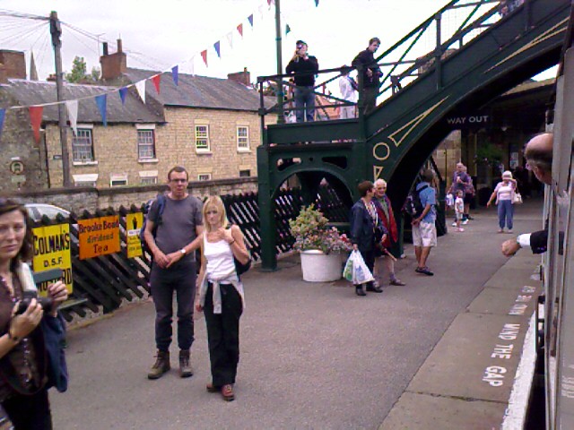
I’m two days and 19 or so miles away from finishing the walk, and my trail has slowed down instead of sped up. I like this. I overnight in Littlebeck today, where several of my walking friends will have also stayed ahead of me.
I leave Ashley House at 9:20a and walk the few miles to Grosmont (Grow Mont) with another guest at Ashley House who’s been walking the full C2C. He is friendly walking company, but I quickly find that it’s best not to be downwind of him. He says he’s been waiting until the end of the C2C to wash his hiking clothes, and the lack of a laundering after nearly two weeks is beginning to tell.


It’s only 4.5 miles to Grosmont on a trail that’s mostly asphalt or gravel farm road after a brief stint through a leafy forest. We pass Beggar’s Bridge just outside of Glaisdale (some romantic story is attached to that, but I didn’t absorb the full gist of it from Margaret), and we move at a good clip to arrive at Grosmont in a little over an hour. The path takes us along the Esk River, which can flood to 6 feet or higher at the ford spots, and has the standing markers and flood-ready footbridge to prove it. Astonishing.


Part of the trail was a toll road in 1940s, with a cost of 4 shillings for a horse and two-wheeled cart, 8 shillings if the cart had four wheels, and 1 pound for motor cars and motor sidecars. A hearse was 6 shillings. We pause at the Toll House, but, alas, no warm chocolate chip cookies are waiting.

My cohort goes on to Robin Hood’s Bay today, so we exchange goodbyes here in Grosmont. I’m taking a stopover for a train ride, before moving on to Littlebeck. I wave hello to the two women from the New Zealander Pack ’n’ Boots club across the street.
“Where you off to today?” I holler.
“Robin Hood’s Bay all the way!”
“Where are the others?” I notice the men are absent.
“Where else?” She points into the grocery. “Getting more food for the walk!”


I wish them luck then buy a ticket for the 10:45 scenic roundtrip train ride to Pickering (the end of the line, a little over an hour away) on an old diesel train that’s reminiscent of the
Hogwarts Express. I can sit anywhere I like, and choose a carriage that has compartments with red cushioned seats and a narrow aisle to walk along one side of the train, a la
Harry Potter. Steam trains make the same Grosmont/Pickering run more often during the day; I’m sad I missed one of those, as this one smells of diesel and lacks the full
HP ambiance.

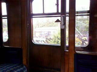
Several adults join me in the compartment and comment on its being like the one in
Harry Potter. One of the women giggles, “Maybe we should dress up like the Dementors and scare the children in the next compartment.”
I like these people.
Alas, they and the children they’re accompanying in the next compartment are all required to be in another part of the train because of their selected stop. The conductor moves them along, and I’m left alone in this traveling parlor room.

The train pulls into Goathland, its first stop, and to my surprise the platform is a shuffling mass of black cloaks and pointed black hats. Scores of children and teenagers, all dressed as
HP look-alikes, have packed onto the platform for the next arrival. I hope they’ll join this train, but as we slow down, the whole body of black begins to stir confusedly, and within moments they are pouring along the platform and going and up and over the overpass to reach the northbound platform, where a steam train like the
Hogwarts Express is slowing down toward us beneath plumes of white vapor.
Turns out that the North Yorkshire Moors Railway, the 18-mile renovated line I’m riding now, was actually used in the first
HP movie—in particular, the Goathland and Pickering stations I’m visiting! Both the stations and the trains are meccas for
HP fans, and this bit of track through the North Riding Forest has become as popular as the train through Glenfinnian, another
HP movie site up north. Like so many other enterprises, the railroad aficionados of the North Yorkshire Moors Railway Society (www.nymr.demon.co.uk) who revived this defunct steam line and converted it into a living museum are undoubtedly indebted to Rowling for sparking the renewed interest that keeps their darling trains going.


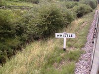

As well as being famous as a movie set, these old-fashioned locomotives are also the kind of trains that prompt people like me to stick their head out the windows like dogs in a car—because we can.
Watching the carriages wind around the bends in the track, seeing flag signals go up and down, gliding through tree-lined valleys—it’s easy to imagine myself on a miniature Lionel train set, humming down the tracks through elaborate manmade topographies like those at the Hobby Hall of the Puyallup Fair.
Me, a tiny person in a tiny train passing through carefully landscaped plywood-bottomed tableaus, past wooden to-scale homes and village stores and blacksmiths shops, over hills and through tunnels made of chicken wire and paper maché, directed by invisible hands that have laid out track and set up electrical switches and flags that tell us when to slow, when to advance, when to switch tracks to avoid an oncoming train.

Only here, at the North Riding Forest, we ride on carved through gloriously green hillsides, past an occasional fen bog, and through a few stops at mostly nondescript stations, save for the colorful bridgework and decor at Pickering and Goathland.
The ride gives me time to sit and think. I’m feeling both sad and happy about my itinerary for this walk, about taking an extra day to get to Robin Hood’s Bay. Sad that I’m not there to celebrate it with my friends (I haven’t met anyone yet who’s also ending on Saturday) and glad that I’ve created my own experience for the journey.
Being able to take my time near the end has removed the driving aspect of the walk—I’ll get there when I get there—and I have the time to enjoy the journey the way I choose to. Rather than make for a final push to Robin Hood’s Bay, I’m entering at my leisure, as part of traveling across England by foot, instead of making “doing the Coast to Coast” a goal in itself.
Early on, I decided to stop saying that I’m “doing” the C2C, and “doing” York, and that I “did” the Isle of Wight. Those phrases carry a kind of chore-ness about them—I did the dishes—and imply that I saw it all, experienced it all, have nothing to return to. Even lingering in a small area for several days at a time often wasn’t enough to “do” it, to take it all in. Having this more relaxed, three-month itinerary has helped, though. I feel as if I’ve lived in England for three months, instead of just traveled and toured through here.
It takes living in a place for four seasons to really feel its rhythms. I wonder what place I should go to next to do that.


The skies right now are turning grayer, and temps cooler. The train has taken me almost twenty miles south of the trail and left behind blue skies and gentle sunshine. At the end of the line, I pick up a pasty-and-crisps lunch at Pickering station and then hop back onto the train for the reverse trip to Grosmont. I move down the train to check out the other carriages; one is a dining car and another full of red velour bench seats, but the others that are far less interesting than the
HP-like compartment.

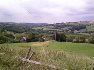


The train ride has been a fun diversion (albeit nap-inducing on the way back), and when I disembark at Grosmont I eagerly return to the C2C trail at a huff-n-puffing 33% incline for the first mile out of town. The climb is a grunt, but it affords a lovely backward view of the village. Following the trail leads me to a disturbing moor, Black Brow, that, rather than expanses of heather, is covered with clumps of spongy, chopped-up moss. It’s like walking on a field of crumble topping.

From here I can see the infamous coastal town of Whitby off my left shoulder, and I get my first glimpse of this whole endeavor’s objective: the North Sea. It is the first sighting of water that isn’t flowing down a river bed, trickling down a beck, or pouring out of the sky in over two weeks.
And once again I get lost.
First I follow the trail over Black Brow, just as it says on the OS map. The trail peters out, so I begin to follow a spotty series of low-lying cairns—sure signs that at least I’m following a blessed path. Then I run out of cairns, too. I see two more cairns in the distance, but up close they turn out to be sheep.
I pause. OK. So no trail. No markers. But I am still facing the right direction, more or less.
I doggedly keep my heading due east toward the A road that I know is ahead, all the while looking around for access to a path that’s supposed to go a bit more southeasterly, per the map.
By now the spongy bits of ground have turned to deep heather and I am stumbling along a vague trail that, I realize too late, is actually a channel made by water runoff. Right after I say aloud, “OK, angels, I could use another trail marker now,” I look up from watching my footing and see a trekker just off to my right—in the perfect southeasterly direction.
“Aha!” I wave his way and yell. He stops and I yell again. “You must be on that trail I’ve missed!”
He waits as I tack over thick heather toward him. Local walking etiquette encourages walkers to stay on the trails, as wanton trekking every which way, especially the sensitive moor areas like this, can quickly deteriorate them. However, given the choice between tramping across 50 yards of moors to get to the trail, vs. stalking another 400 yards through even thicker stuff to reach the road, I elect the shorter route and lift my legs high to march through heather that’s so thick my feet never reach the soil where I tread. The plants are soft and yielding, like walking over mounds of stiff foam pillows.
The walker is a tall man, easily in his 70s. He has a small pack and a walking stick, wears trousers and jacket and cap. He has taken a bus and “walked over here from somewhere over there,” pointing vaguely toward my destination of Littlebeck across the A road. He is heading to Grosmont where he’ll catch a ride home, preferring this plan to the alternative of driving to a car park and walking. “When did you start your walk?” he asks.
“July 17.”
“About 18 days. I walked it twenty years ago in 10 days, maybe 12. I did two walks then, Pennine and the Coastal. Can’t remember which one took me 10 and which took me 12.”
I hear that the Pennine is usually 18 days at a pushing pace, so this fellow must have been really moving. And certainly to do a 20-mile day at the beginning of the C2C is to turn it into an ordeal. I can still feel twinges of pain in my knees when a downhill path gets really steep—those Lake District fells were rugged, even with trekking poles.
He gives me guidance on the track ahead: “You’ll cross the road, then follow that valley somewhere over there, lots of twists and turns along the river.”
Not very specific, and because I’m heading for a farm outside of Littlebeck tonight, his directions aren’t true to my path, so I ignore them once I cross the highway.
Littlebeck Intake Farm is easily spotted in the distance, and I follow a gentle downhill detour to approach the farm from the back, instead of the usual alternative that would have meant going uphill to reach it from the front. (This is one of the few tips I recorded from the little research I did for this walk.)
These OS-marked footpaths not only take me directly around and in front of the gardens at the neighboring High Quebec farm, but also between the buildings of Low Quebec Farm and through its back garden, right between their swing sets in the trees and their polytunnel. In the center of the garden stands a two-way finger post to direct the many walkers who undoubtedly pass through here. I still marvel at the freedom this public access thing throughout the UK. In America, “No Trespassing” signs would be posted at every possible ingress.

I arrive at Intake Farm around three. Owner Robert and a collie, Ben, meet me in the farm yard; his wife, Judith, comes in from feeding the hens and we talk as she feeds me tea and homemade cake in her kitchen, clearing magazines, mail, and papers from the crowded table as if I were an old friend dropping by for a visit.
Intake Farm is one of two B&Bs in Littlebeck, but it’s really the only one worth going to, and almost everyone on the C2C who makes Littlebeck their last stop passes through Intake Farm.
Several of my fellow travelers have stayed at her place since Tuesday. I’m the only guest tonight, Friday, for which she is grateful; last night she had nine, including those who camped in the fields. She prepares rooms, feeds dinner, and feeds breakfast to six to eight people every night for a week—even more when the weather turns wet and campers come in for a cot and hot tea.
Michael and David had come on Tuesday. As I sit outside with Judith in the sun, the Sherpa Van man arrives with my bag—today is the only day on the walk that I actually beat my luggage to my destination. The Sherpa fellow says that he had met David and Michael two days ago at Robin Hood’s Bay to take them back to Richmond, where they had left their car at the beginning of the walk. They had arrived at RHB in the pouring rain, met the van, and had changed clothes in the back of van, singing the whole time, so pleased they were to be done.
John and Elaine had arrived at Littlebeck that same day, sopping wet from having walked 20 miles from Blakey Howe, most of the time in the rain. Andy, Jenny, Len, Marja, and Nico were all here last night. Each day, Judith’s visitors had told her about this American woman, Audrey, who is traveling alone and would be staying with her. They all said, “You’ll like her!” and Judith and I have a great laugh over this reputation that has preceded me.
The only C2C companion I haven’t heard about, then, is Marv, and I think he’s a day ahead of me, probably pulling into Robin Hood’s Bay today.

I shower, rub balm into my feet, set out my laundry for washing, then play with a few of the farm’s many cats—Adolf (shown here), Lil, Bill, and Jill—and use their broadband (yay, fast!) Internet for a couple of hours of e-mail. I am arranging for Patti to pick me up at the airport on Tues evening, when I get home on Aug 15. I’m glad to know I’ll have a friend waiting for me.


With my warmest socks in the wash, Judith supplies me with house slippers to keep my toes toasty as the evening turns a little chilly. I select the purple fuzzy ones with ladybirds and sit down to a yummy dinner of shrimp cocktail starter in a homemade “rose marie” sauce (cream, mayo, tomato juice, lemon juice, Worcester sauce); chicken casserole, new potatoes boiled in mint, cabbage steamed over the potatoes, and cauliflower au grain. Dessert is fresh fruit in fresh cream with ginger-lemon herbal (with H pronounced) tea.
Well fed, relaxed, and ready for bed, I am feeling content and just a little sad. Tomorrow: the last 12 miles to Robin Hood’s Bay and the waters of the North Sea.
Trail miles: 7.5; actual miles walked: 8
 I had planned to stay an extra day at Robin Hood’s Bay, and am glad I did. I want to relish the completion of the Coast to Coast walk. Most of my friends left the day after they arrived. Michael and David headed back within hours of finishing on that rainy Wednesday...sopping and singing and changing clothes in the back of the Sherpa van that came to return them to Richmond for the drive home.
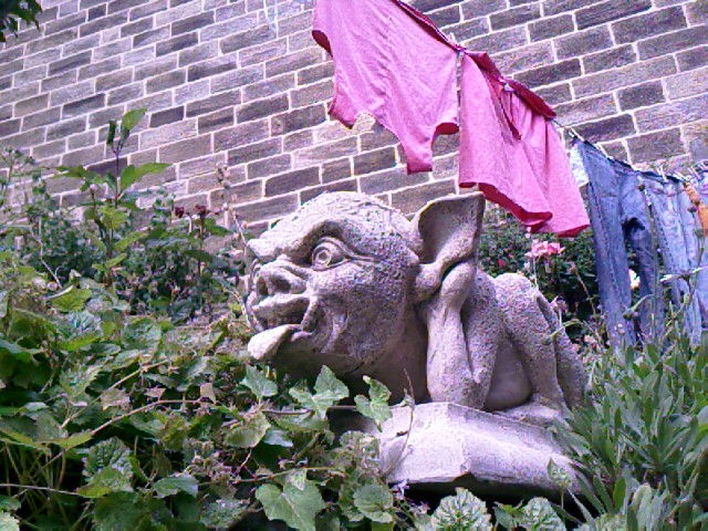 The morning is easy. Sleep in ’til 7:30, eat breakfast at 8, say goodbye to Marv, nap again ’til 10. Walk into town and buy postcards and a replacement shirt for the two I’ll be tossing soon. They got seriously faded in bands across the shoulders and the front from sweat and the backpack and repeated washings these past two weeks.
 I wander around a lot today. My feet don’t seem to want to stay still after all that walking. They also don’t want to be in shoes, so I get to feel the sand and asphalt and stones of Robin Hood’s Bay and its village a lot of the day.


 I buy a strawberry ice cream from the on-the-beach ice cream van, meander the labyrinth of skinny side streets and stone steps, sit on the slipway watching beach goers.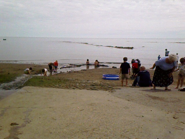

 Families and children are digging sand, making walls against the tide that overruns them as quickly as they’re built. People push strollers along the packed sand, up and over cobbles on the slipway, through rivulets of water running to the sea from the town’s stream. There is a strong smell of sea today: a muggy, seaweedy smell. A sweet fragrance of pipe tobacco passes by—he is the only pipe smoker I’ve come across this trip.
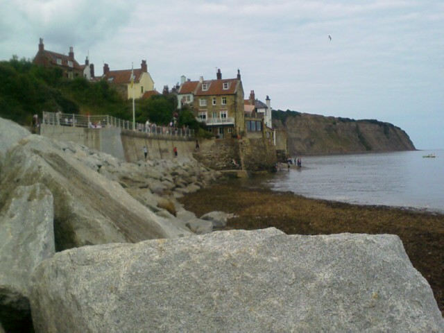 This beach and how people enjoy it is very different from Wight, Cornwall, St Bees. There are no miles of hotels, sand, and beach houses like at Wight; no rugged boulders and crashing waves like at Cornwall; no evenly spaced jetties and water-level boardwalk like at St Bees. Here is a towering seawall built to bolster the village from dropping into the sea. Beach that disappears rapidly with the tide; a main street that slides directly to the water; boardwalks along the top of the seawalls; concrete ramps and steps that lead down to the sand at low tide and are barricaded with chains at high tide.
 A boy and his dad have made a sand boat at the base of the northern seawall. The flags are fish nets stuck up at each side. The boy sits on a towel in the boat, “Because,” his mother explains to me, “he hates to sit in the sand.” They soon have to abandon ship with the swamping tide.
 Waters overtake another deserted sand fort, and farther on three children are desperately trying the protect the stronghold they’ve abutted to the seawall.
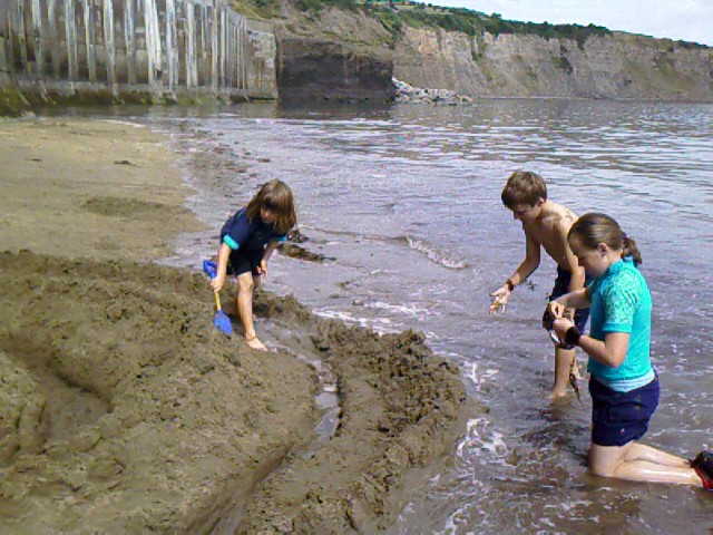 “This one’s called The Flying Cape Castle,” says the boy as he and his sisters fortify the third ring of sand against the incoming sea. Their father comes by and we chat a bit. They’re from Suffolk, Cambridge area.
 The servers are sassy twenty-somethings, all men, and loving their popularity at the busy lunch hour. I drop a tip into their “Staff Beer Fund” as recompense for the photo I take, and one of them says, “Thank you miss. For that, you get something extra.” He lays one extra chip speared with a wooden fork onto my meal box. “See that, folks?” he says to the rest of the patrons. “Generosity never goes unrewarded.”
 Blowing the heat off the fish and chips, I take a bench at the upper boardwalk for more people watching from the overview point. A fellow next to me plays Sudoku. The sun keeps coming and going, brilliant and hot when it’s not behind clouds, which is where it’s been most of the day.
 The Morris dancers are still here, so I catch a more of their show and mostly hang around the village for the rest of the day. I am feeling like a tourist again, only different. More able to sit and just be here. That is enough for now.