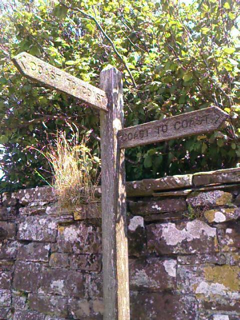
Thursday, July 20, 2006

C2C Day 3, Stonethwaite (Mile 29.5)—Lofty Goals

I am traveling a road that thousands before me have taken, yet it is still new, for I am embarking on it for the first time myself.

Today is 15.5 miles, from Ennerdale Bridge to a little village called Stonethwaite. Dorothy’s daughter gives me a lift from the farm to town, so I don’t need to walk the same 1.5 miles from their farm again. I stop for cash at the town’s hotel, where, for the first time ever, I actually drain the ATM of its remaining funds—£70—while asking for a larger withdrawal.

I am also planning to buy some snacks before I leave Ennerdale, but the grocer recently closed down, and there are no other stores in the village. How can a village not have a grocer? But there it is—no grocer. I resign myself to trail bars, peanut butter crackers, and water for my lunch break. I’ve forgotten to request a sack lunch from Dorothy.

Today is much cooler than yesterday, for the heat wave has finally broken. A light rain falls as I shrug into my small daypack at 9:10a and head out of town toward the long lake that is Ennerdale Water.

Wainwright describes today’s walk as “easy, with no difficulties of route.” Almost three miles along Ennerdale Water, a four-mile forest walk to Black Sail youth hostel, and the rest of the way over hills to Honister Pass and Borrowdale, a valley that houses several hamlets that, says Wainwright, know how to cater to walkers who have “outsize appetites and tired bodies.”
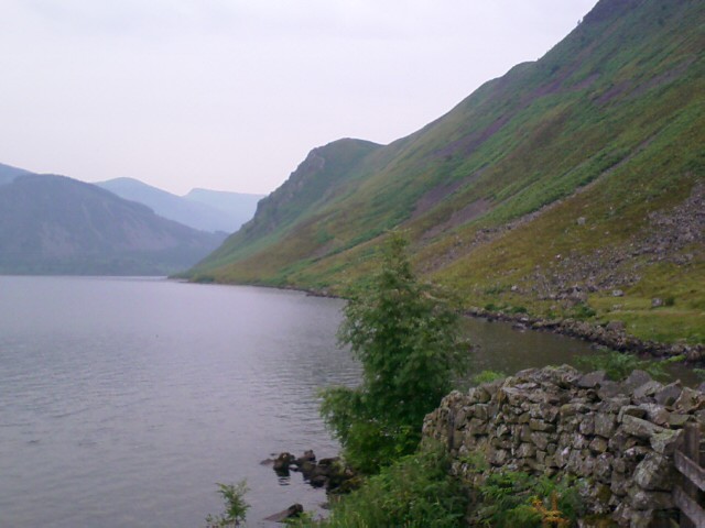
I start out alone, but am soon overtaken by two C2C’ers near Angler’s Crag, a rocky outcropping on the lake. We pause for introductions. They are Michael and David, brothers, both retired, from Nottingham.

“Traveling alone?” asks Michael with a friendly grin.

“Yes.”

“Well done!” He gives me a round of applause.

Turns out that Michael has walked UK’s trails for 50 years, traveling over many parts of the C2C path, but never all in one shot. David, like me, hasn’t done much long-distance trekking. This is his first time on the C2C—part of his recent retirement celebration.

He’s not sounding particularly celebratory as we compare notes about yesterday’s walk through the second day of heat wave. They had taken the Dent route, and David had suffered from heat exhaustion over the top.

“I nearly died out there!” he says with a half accusatory look toward his older brother, who’s apparently the mastermind behind this idea of the C2C as a sendoff into the life of retirement.

Michael laughs, “Oh, you did all right. Not like that mother and her daughter. You hear about that?”

I shake my head. Michael’s voice and accent remind me of Wallace in Wallace and Grommet.

“They went over Dent yesterday and got turned around on those trails at the top. Heard they were still up there at 7 o’clock, and finally found their way back down the western side and ended up back in Cleator.”

“I’m glad I didn’t do the Dent then,” I say. “I took the easy way around, going along Flat Fell.”

“What!” says David. He turns to his brother. “You mean we didn’t have to go over the Dent? What else are you not telling me about? I could’ve died out there, you know.”
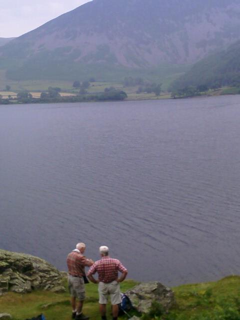
We all laugh, then we sort of walk together up to Angler’s Crag, where we take separate breaks, wave a farewell, and they move ahead at their faster pace.
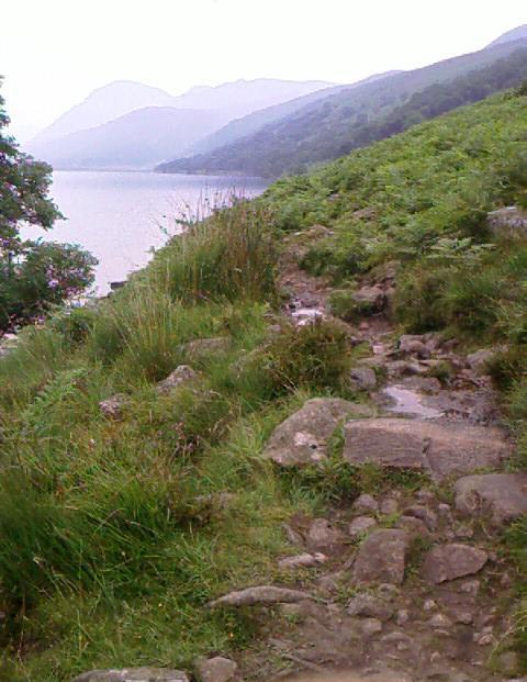
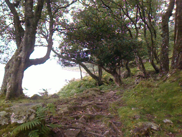

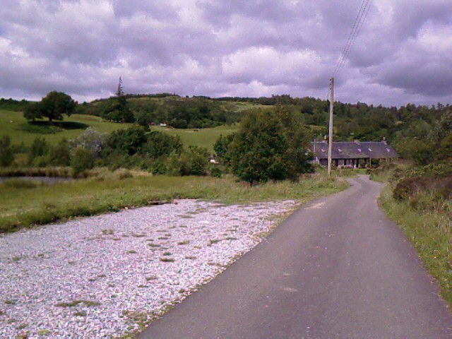
The rain has let up, the air is muggy, and the morning haze has just about burned off. I peel off my rain jacket and roll it up to attach it to the bottom of my daypack. The trail along the water is easy to follow but rugged, with lots of stones, rock-strewn gravel, and a brief bit of scramble over Angler’s Crag. The second half is punctuated with lovely wooded areas like grottos, but rather than smooth footpaths, there are tree roots everywhere, each one a potential trip-up.
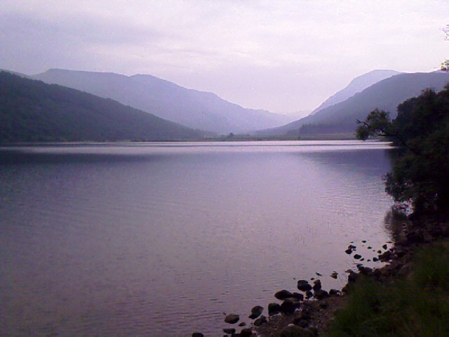
The only safe chance to take in the view is to stop and look around. Otherwise, it’s an unrelenting near-three miles of watching where every foot falls to avoid falling on my face. Very slow going. Still, I do pause often and am rewarded with breathtaking views across the lake, ahead to where I’m going, and back from where I’ve come.
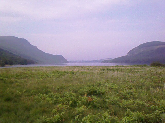
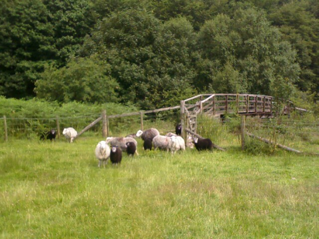

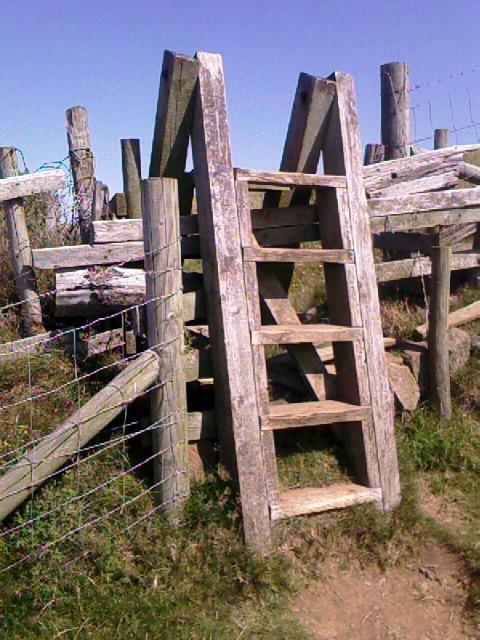
The path along the water ends in a track that allows for a lovely final backward glance before it crosses a field of sheep. The transition from there to forest road happens over a wooden bridge that this morning is blocked by several fat sheep and lots of white and black lambs. They mostly scatter as I approach, but one little fellow panics and gets himself onto the bridge platform, too afraid to go past me and unable to get through the stile that keeps animals off the bridge. I back away reassuringly, and after a few more failed attempts at the stile, the lamb scrambles back to the grass yelling for its mother.

A noon lunch break at the Ennerdale YHA, at Gillerthwaite, gives me the chance to kick off my boots and rest on the grass under a shady tree. I am at mile 19 of the 190-mile trek, and a little over five miles from today’s starting point. The hostel is locked up at the moment—no chance of an indoor toilet. As usual, the hostel guests are gone during the day, and only two other people, staff by the looks of it, come through the gate while I sit here. Some bicyclers on the forest road behind me are noisy and yelling to each other as they part at the gate. They sound like a boisterous group of nine, but there are only four of them.

My toes are holding up magnificently with the lamb’s wool—thank you, Christi, for that dancer’s tip—and I’ve collected a little more from the fields and nettles over the past two days, so I have a good supply. They washed up wonderfully in the machine inside a nylon stocking stuff sack at Low Cock How farm.

Ahead of me is a four-mile track of forest road to the Black Sail hostel, then a two-mile tricky bit that follows cairns instead of fence lines. Despite Wainwright’s assessment of the trail, I’ve been warned that the area is easy to get lost in. I’ll need to be attentive to my surroundings, not just to my feet.
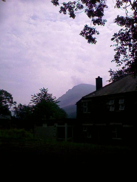
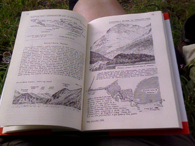
The jutting mass of Pillar Rock, one of the many landmarks that Wainwright had lovingly drawn in his book, is visible beyond the hostel at the east. I read about it in the guide—his drawing matches the profile well.

Starting off again after lunch, I know I’ll make good time on this bit of road. True to Wainwright’s description, however, Ennerdale Forest is a trudge. And a misnomer. It’s really an enormous evergreen plantation, much like the ubiquitous Weyerhauser and Simpson woods in the Pacific Northwest. The same kind of trees—they look like firs here—planted as a crop for their wood. They are homogenous in species and size, crowded together, falling over onto each other like pencils in a jar.

Except in Wainwright’s days, more of the trees were actually there. Now most of them to the north are gone, the plantations having been harvested in a clearcut that leaves hillsides denuded of all but brown stumps and debris. To my left, the bald fells of High Stile, High Crag, and the Haystacks—a favorite ridge walk of Wainwright’s and one that he describes as being “for very strong and experienced fell walkers (only)”—hold the northern horizon away from view. To my right, trees tower and often block the view of the southern crags, and I am lucky to catch a glimpse of the River Liza that flows down the valley to feed Ennerdale Water.

The trail isn’t some lovely little nature walk curving through the remaining woods, either. It’s a straight-on, dusty, unrelieved, exposed gravel road that’s built strong enough to be used by logging trucks. “Just keep plodding along the forest road,” says Wainwright, and he’s right.
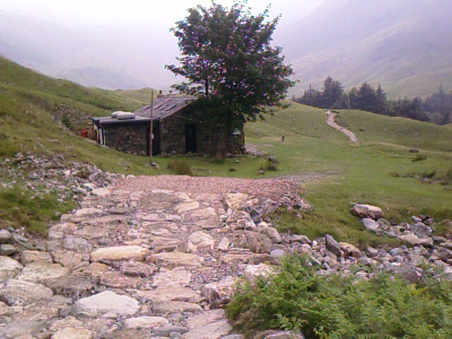
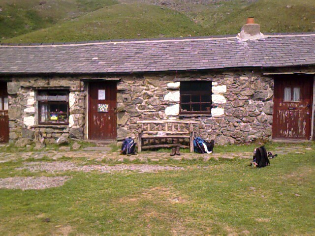
A little after 2:00p, the Black Sail hostel, one of the smallest in the YHA collection, is finally in sight. Woohoo! I am out of the clearcut and back into sheep-grazed, grassy hills.

I come around to the front of the hostel, and who’s there on the benches but David and Michael! They praise me for making it here. They’ve just finished lunch and are putting socks and boots back on. David counts multiple blisters.

Unfortunately, the hostel is closed due to unforeseen circumstances—full septic. No toilets. No water. Drat. David and Michael fill their bottles from the hostel’s filtration system up the hill, and they welcome me to join them when I ask if I can travel with them through Loft Beck, that tricky bit of today’s walk.
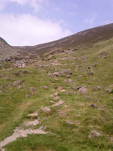
The trickiest bit turns out to be guessing which steep hill to climb: two of them face us once we follow a shorter side trail from the hostel to the end of the valley. Which one is Loft Beck—the one at the left with all the scrabbly rock and no apparent path, or the taller one to the right that has a faint path up part of it? We spend 15 minutes comparing maps, notes, Wainwright interpretations. David and I, neophytes that we are, dare to outvote Michael and suggest we take the scrabbly track at the left. It seems to fit their OS maps better, as well as descriptions of where to go in my Footprint map.

Willing to give it a go, Michael forges ahead up our chosen trail. David and I push on much more slowly, clearly lacking the mountain-goat blood that Michael has been endowed with.

Michael is practically a white dot against gray rock when he calls down from about halfway up, “There are steps!”
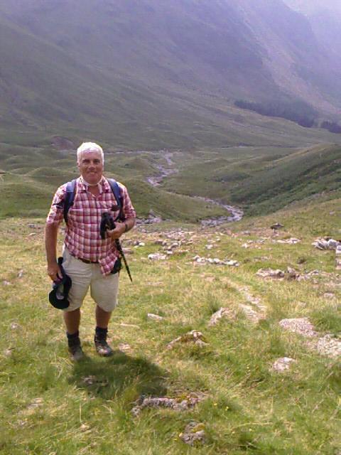
Hoorah, we’ve chosen correctly. I repeat the news to David, who’s not far below me. “We did it! You chose the right path!” I whip out my camera, and David whips off his hat for a photo of the happy moment.

The climb for us is arduous, and David and I buck each other up with jokes and encouragement in between rest stops to lower our heart rates. Michael has disappeared over the top of the hill and doesn’t answer my yells.

“He’ll never hear you,” says David. “He’s long gone. Just wait, when we finally catch up to him, he’ll be all rested, we’ll collapse, and he’ll say, ‘OK, let’s go!’”
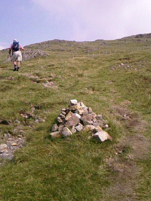
The cairns at the top of the hill, which I expected to be difficult to spot, couldn’t have been easier to follow if they’d been neon signs. They are huge pyramids of stones and seem to be placed every two hundred feet. Michael is still nowhere to be seen.

We finally meet him resting among the cairns, having waited at least 20 minutes for us to catch up. His handkerchief is draped over a trekking pole like a white flag. Just as we approach, he grins and acts as if to stand. “Let’s go!”
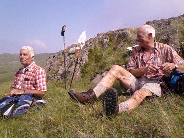
“See?” says David. “I told you, didn’t I?” He drops down to the grass and groans, “Good thing we’re not expected to have sex once we get up here.” We all break out into laughter.

“Right,” I say, also folding to the ground in relief. “The only thing we would get up here is our bodies.”

We all laugh heartily. It feels good.
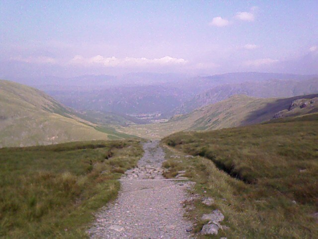
The trail leads next into Honister Pass, an old slate mining area, where Michael and David will stop for the day. I am to go on for another three miles to Stonethwaite. The trail to Honister is not only well marked but well trodden. The rocky, uneven ground is even more rough going than Ennerdale Water, though, and my feet and ankles hurt, and my legs are tired.

The last downhill trail—an old tram road that was used to haul slate down from the mine to the processing plant—is grueling in itself: more of that uneven slate and stone jutting all over the place, plus lots of loose rocks. “Ankle breakers,” Michael calls them.
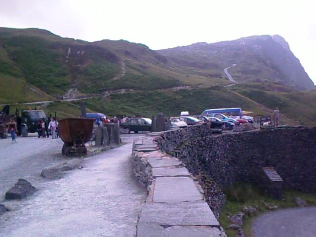
We pull into Honister Slate Mine/Museum/Shop at 4:50p, and I take a half hour break on a slate wall and take a moment to appreciate the snaking trail we just came down. We exchange contact info and kisses and goodbyes. We’re likely to catch each other on the trail to Grasmere tomorrow. Their itinerary ends Aug 2, mine Aug 5; our schedules split off around Keld, I think. Michael tells me I’m supposed to go to the Wainwright Chip Shop in Kirkby Stephen to sign a C2C travel book. It’s close to the halfway point of the trail.

I leave for Stonethwaite, with the intention to have a leisurely supper stop at either Seatoller or Rosthwaite on the way in. I hope to get the Stonethwaite by 9p, which is still daylight at this latitude and time of year.

I reach Seatoller within an hour of walking down another rugged trail, and duck into a restaurant to buy a yogurt and banana to tide me over until dinner, as well as three OS maps to get me over the Lake District and through to Shap, a few days away.

After seeing the additional information that Michael’s OS map provided today, I’m feeling the need to supplement the Footprint maps. The greater topographical detail and wider geographical context allay my fears of getting lost or being unable to take an alternative path if I need one. Too bad OS no longer makes a C2C system map, though—it takes lots of individual maps to piece the whole path together.

I decide to forego the official C2C trail from Seatoller to Rosthwaite so I can stay on the paved road. My feet appreciate the level, smooth ground, and there’s a decent shoulder or sidewalk most of the way.

My arrival at Rosthwaite around 7:00p means I’m just in time for supper at the local pub. I order dinner at the bar with the recommendation/help of a patron who’s the brother of the chef and used to work here, and find a table at the back of the main room. I pull my daypack off and begin telescoping my trekking poles for storage on the booth seat.

From a table nearby, a man says with a smile in his voice, “We should all be wearing a sign saying ‘Coast to Coast Walk’ on the back of our packs.”

He’s bearded, friendly, and the male part of a couple in their late ‘50s or so.

I manage to pull out enough energy for a chat. “You too?”

“Yes. We just came from Ennerdale hostel. Very crowded last night. They had to take in several people from Black Sail because of emergency septic problems at Black Sail. Are you American?”

“Yes. Seattle area. You?” I can’t place his accent, although it sounds familiar.

“Australia. Where are you staying tonight?”

“Stonethwaite Farm, half mile or so down the road. Heading to Grasmere tomorrow.”

“So are we!” says his wife. “Where are you staying?”

“The hostel, I think.”

“Oh, we’re going there! Which one?”

I dig out my notes. “Uh, YHA-Grasmere.”

“Isn’t that great? We’re staying at the same one. Perhaps we’ll see you there, then.”

Another couple from across the room starts talking with the Aussies about the C2C walk. They seem like locals who know a little about the trail, and are familiar with meeting walkers. My dinner arrives and I’m far too tired to keep up with the cross-room conversation, so I disappear into the pleasure of lamb shank with jacket potato and salad and sticky toffee pudding with ice cream. I’m very hungry, and very eager to get to the B&B and collapse for the night.
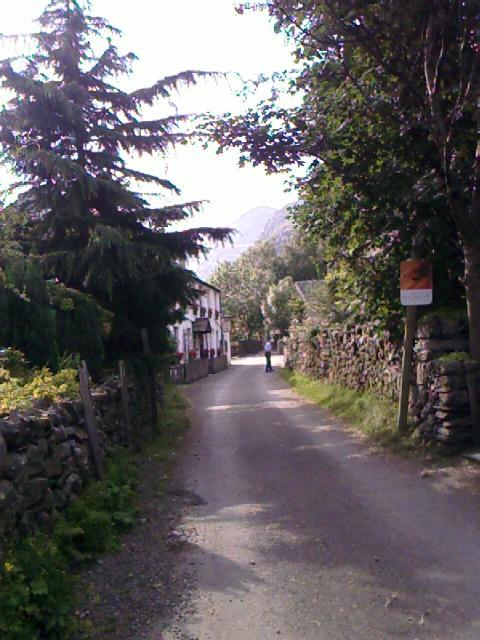
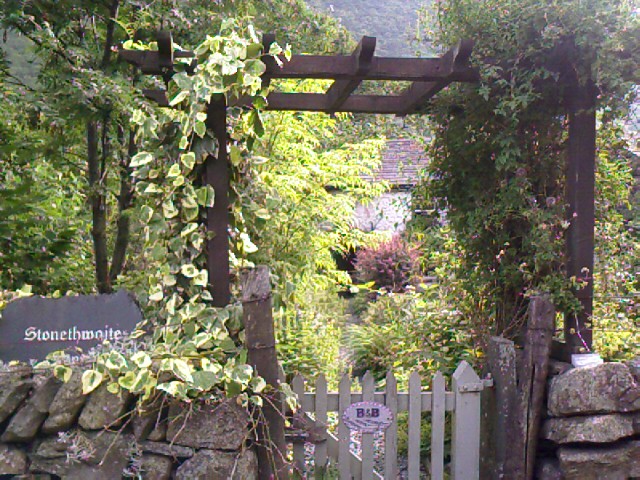
After a few false turns and wanderings, I finally find Stonethwaite and Stonethwaite Farm. Tracey, the proprietress, has left me a note on the door to find her at a pub down the street. She and some girlfriends are having dinner out. She breaks away from her meal to settle me into the farmhouse.

It’s another cozy renovation with white plaster walls, unsquare corners, and walls wider at the base, plus the added challenge of slanting floors in the hall, my room, and the bathroom. It is reminiscent of the Haunted Shack at Knotts Berry Farm—I lean slightly uphill to walk into the room, sit down on the toilet by falling slightly backward, and take a bit of extra effort to get up out of bed to the left because of the floor’s uphill tilt in that direction. It is, however, altogether warm and comfortable.

Oh, to shower, to sit, to rub oil on my feet, to lay myself down on a bed and ruminate after today’s rough trek! Luxury following luxury. Foot inspection shows signs of stress at my right foot big toe, fourth toe, little toe—tenderness and white skin. The left foot has only the two smallest toes hurting as yesterday, but no fresh blisters. The wool is doing wonders for my comfort; I found more fresh wool to use today, this time in gray and black, too.
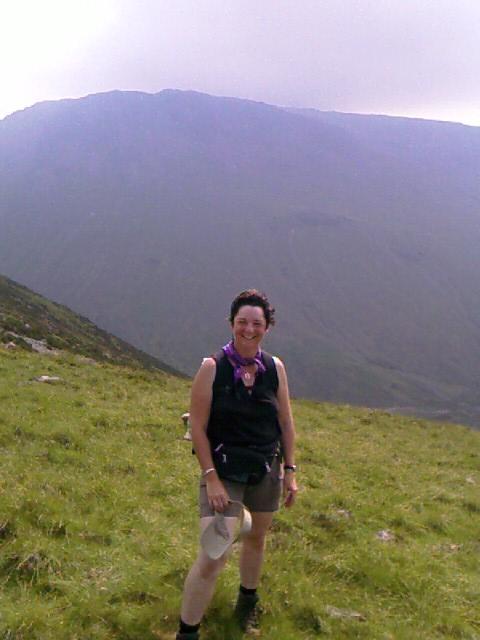
Everyone creates their own C2C walk, and I am, too. That’s the fun of meeting people on the way: finding out how they’ve decided to do it, comparing itineraries. And having the chance to share groans over the tougher parts of the trail, or highlights of what we’ve experienced.

My highlights today were definitely meeting Michael and David, and accomplishing Loft Beck. And making it all the way to Stonethwaite after more than fifteen rough-going miles, before dark.

Trail miles: 15.5; actual miles walked: 16

Wednesday, July 19, 2006

C2C Day 2, Ennerdale Bridge (Mile 14)—Shoot, Overshot

I fall into bed at 9:30p Tuesday night and sleep well until 1:39a. Hot in the room, so I open the window and the French door. A breeze rustles the curtains against a dried flower arrangement in the recessed window. I step outside onto a landing that overlooks the back garden and stable yard. The white laundry from the B&B is pinned to two rows of line on the lawn. Towels, sheets—vast expanses of fabric. The breeze moves into them, and the center pole sways like a poorly anchored mast. To and fro, to and fro in a slow rocking wave.

I can see the stars tonight. The Milky Way, even. Faint because of the amber street lights around the corner. The Little Dipper is just visible beyond the rooftops to my right.

I remember something I sometimes forget in my day-to-day details: “The sun is always shining, the moon is always full, the stars are always present.” It’s that big-picture faith that I keep losing sight of—that faraway vision I would do well to hold to.

I’m not so far north now, and it’s dark enough to see stars. Another reminder that I’m no longer in Scotland.

A satellite slides across the sky north to south; a meteor shoots away at the southwest. Bats flit like oversized moths in and out of the pale light around the buildings. I stand in a T-shirt and briefs, feeling cool for the first time in two days. My bare feet feel the bumps of aggregate concrete, also cool. My hands rest on a rough concrete wall.

My shoulders are tense. I relax them. Relax them again 30 seconds later. My legs are tight. I shift my weight to stand more squarely. My ankles hurt a little to move. My shoulders tense again. Why do I expend so much energy merely standing?

And lying down for that matter? Even as I return to bed to type on Perry, I can find opportunity to relax my legs, belly, shoulders, face—repeatedly, nearly every 10 seconds.

Tension must be a habit. A flight response, a freeze response, a get-ready-to-do-battle response, a be-ready-to-run response.

What would change for me if I were willing to let go of all that tension while stand, lie, or sit? Would it also dissolve when I walk? Would I expend less energy living? Ensuring my survival? Would I still be enough after letting go of the need to be “ready for anything, bring it on”?

That’s how I’ve felt much of my lifetime here. That I’m supposed to be ready. For anything. Rain, snow, heat. Trouble, danger, mishaps. Tests, quizzes, hidden traps. God, as I have seen it, has been someone who puts obstacles in my way just to see how I do with them. Pass, fail, grade. All about getting it right or wrong or better than what I did before or than what others do.

And most of my life I’ve been functioning in fear that I won’t be ready. That I’ll get lost, be without something I need or without something someone else needs, not have the answer, miss the turnoff, not arrive on time, not have everything together, not be rehearsed, prepared, overprepared, careful, careful enough.

Fear, fear, fear. Focusing only on the one goal at hand, myopic in my concentration.

That’s what I notice most about my habits tonight. That I’ve been creating myopic vision in my life since I left college. And that it’s time to start letting that go.

* * *

I stack my bag alongside others in the lobby of Stone Cottage for the Sherpa people and head out at 9:02a for the 9.5-mile walk to Ennerdale Bridge. I’m finally going officially eastward on the walk, and I feel eager and confident. I have a choice of following the Footprint map trail, which takes me around Flat Fell, or Wainwright’s preferred option of going over Dent. The early heat of the day makes the Dent less likely, but I decide to decide on that when I get there.

An hour and 2.5 miles later, I sit down for a break in a shade-covered lane with hedges on both sides. I’ve just passed under an unused rail trestle that’s been converted to a bike path and am nearly at mile 7 of the C2C path. The A595 is a short ways away. Peering back down the lane, I can just see under the trestle and to the cow fields and stream I’ve left behind. I have learned to take every stream and brook that’s presented as a chance to wet my neckerchief, and the front of my pink cotton T-shirt I bought in Salisbury (thank you, Marks & Spencer) is dark with water. It feels cool on my skin.

The cows and sheep were very accommodating as I crossed their territories this morning. I tried to skirt them, but sometimes I had to go straight through a group. The sheep usually scattered, but the cows stood around and followed my progress with their massive heads and placid brown eyes and slow, cud-chewing jaws. I said hello to them all.

I am still hearing booms of navy guns in the distance every 20 minutes or so. I peel off my boots and socks and put some found lamb’s wool around my fourth toe on the left foot—a tender area for blisters.

The trail hasn’t been as well marked as I expected it to be. I am trying to focus on my surroundings, not just the path and map, which makes it easier to figure out where to go when the path becomes faint...something that happens across these fields.

I reach Cleator (mile 9 on the trail) at 11:02, feeling hungry and hoping for a public toilet. A ask the woman behind the counter at a grocer where the nearest restroom would be.

She states flatly, “There are no toilets in the village.”

I don’t take this news with particular grace, but I thank her anyway and head out. The Three Tuns, the local pub, is closed because it’s too early for lunch, so that’s out. I walk about a half mile north through town hoping to find a park or recreational spot or fuel station that might offer facilities, but I eventually turn back, having chosen a road that’s clearly not leading to additional civilization and not wanting to spend a lot of time wandering around.

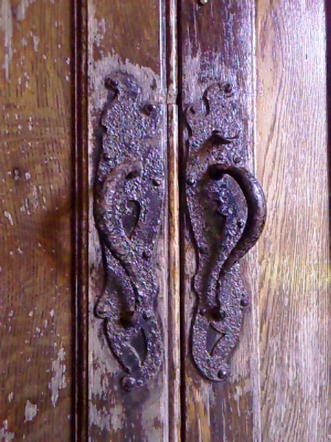
I return to the grocer, buy a warm onion/cheese/potato pasty, a banana, and fresh water and try to find a place to sit down in the shade for lunch. I end up backtracking to the local church, where I push through the iron gate and take refuge under the arched walkway outside the church doors. The building is locked shut. The chill of built-in red sandstone benches is welcome to my overheated body, and I sprawl out to use as much surface area as possible. The date “1903” is carved above wooden doors whose hardware has weathered poorly. The cemetery is about 10 yards away, and a flower garden is in full bloom in front of me.

On leaving Cleator, I am desperate enough for a toilet that I double-back for two blocks to return to a white-haired lady I had seen working in her garden. A cane is propped beside her. I gather my nerve. “Uh, excuse me.”

She doesn’t hear me. Right, elderly. Probably hard of hearing.

“Excuse me!” I say more loudly.

She looks up. “Yes?”

“Um, I’m on the Coast to Coast walk, and could really use a toilet. There are none in town.” I point back to the main street. “May I use yours?”

She smiles and straightens. “Of course, dearie.” She grabs the cane, totters out of the garden, and leads me through her screen door. “Down the hall to the right.”

My single impression of the house is that it’s pink—everywhere. Walls, carpet, side rooms. The bathroom, too. It’s equipped with a handicapped toilet that has a cushy padded seat and chrome handrails on both sides, like some kind of bizarre office chair for an aging CEO. A cute little corner shower. Pink towels, pink soap, white flooring.

As I thank her profusely on the way out, she asks of my whereabouts, wishes me good luck, and points me to where the trail continues down the street and around the corner.


The temperatures are soaring, and I have definitely decided not to walk over the Dent. This is an exposed hill that offers many criss-crossing trails at the top (read: great potential for getting lost), as well as some steep descents down to a charming-sounding brook called Nannycatch Beck on the far side (read: hard work on a hot day). Despite Wainwright’s obvious penchant for this part of the trail, I opt for a lower path that will take me along the north side of Flat Fell. It’s also treeless, but with no altitude gain and seems a little more direct to Ennerdale Bridge.

I pull off first at Blackhow Wood, though, to snack, drink water, and nap away the noon heat under huge alders. This is the only bit of wood I’ll meet up with on today’s walk. I park myself on a spot that has very little grass and a few tree roots to use as a pillow. I’m on such a slant that I must position myself carefully so I don’t slide downhill as I snooze. It feels good to take off my boots and socks.

The Footprint map I’m using works like tunnel vision—great as long as you stay in the tunnel, but not so great if you want to know how the tunnel relates to what’s outside. It has basic contour information, but that may only extend to a mile on either side, and therefore not illustrate a hill that I’m looking straight at a few miles away. And not everything is labeled, either—some farm buildings might be a little unnamed black square, for instance, and paved roads or streets generally go unidentified.

So when the trail that I follow around Dent and to the beginning of Flat Fell peters out where the map says it should have continued on a left fork, I am more than mystified—I am miffed. No amount of searching for a path gets me onto anything more than a labyrinth of sheep trails on the hillside. I drop down lower, find a horse trail and a gate, but that trail dies off, too. Sunshine is beating down on the open fields, and I’m hot and sweaty and crabby. I gamely continue heading east, tromping through knee-high grass until I spot the Meadley Reservoir—a mapped landmark that at least assures me I’m on the right track. Oh yay.

But still no trail. I struggle up Flat Fell to search for a stile in the stone wall to get out of my current field. No such luck. Panting, headachy, and grumbling, I rest in the meager shade of the wall for ten minutes and then dare a careful climb over the rock and wire fencing to reach a proper trail on the other side. Whether it’s the actual C2C path or not, I’ll never know. But it does seem well used. I pass the rotting carcass of a sheep in a ditch; its matted wool is marked with blue paint—the brand of its owner. The sheep looks like a coyote had gotten it.

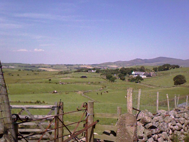
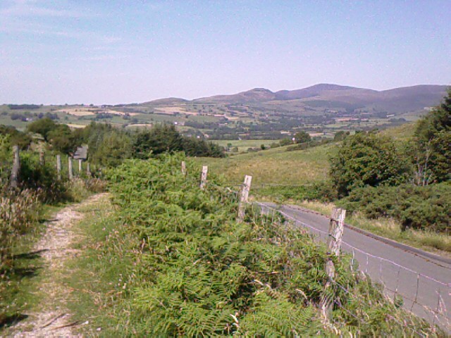
My mood lifts as I spot the glint of cars in the distance. It’s the main road into Ennerdale Bridge. Still on the fell, I pass within a quarter mile of a farm in time to watch a fellow and his two dogs work sheep from paddock to paddock. It is an amazing sight, with a hundred or so sheep all pouring through one gate, spreading out in the new pasture, and being collected again to funnel through another opening in a different wall. Now I know why Pip at Torlundy was always crouching to herd the chickens. These dogs do the same to keep the sheep in line.

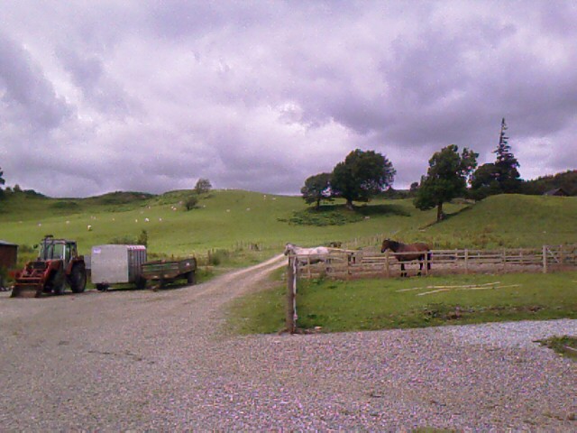
At another part of the farmyard, seven draft horses amble down the gravel road from the barn to a field to graze; no person is guiding them. I am fascinated by their calm deliberation.

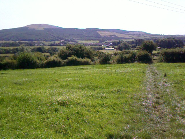
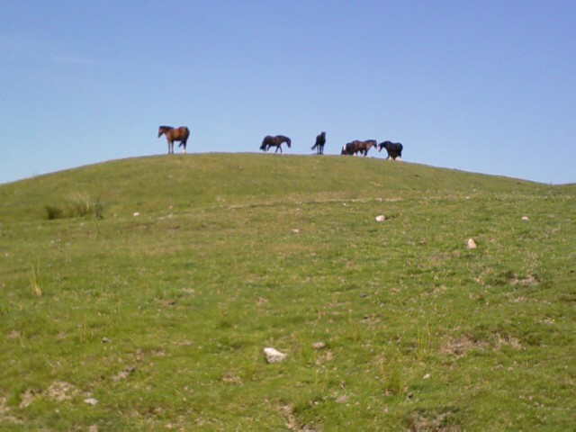
I finally leave Flat Fell through a rocky gully that’s the end of Nannycatch Beck, and come to a paved road where horses are standing and grazing on mounds that are right by the street. No fencing is up to keep them from the cars, and they seem perfectly safe and content.


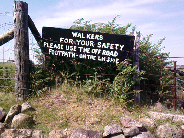
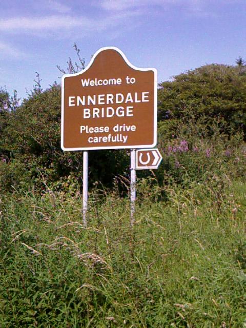
The final stretch to Ennerdale Bridge, another one and a half miles, goes along a footpath that parallels the road which, true to UK form, has no shoulder that’s safe to walk on. Once I arrive at the sign announcing my arrival at Ennerdale Bridge, I call my B&B for directions, but the fellow who helps me is as muddled as I am about my current location and what direction I’m facing as we talk. He tells me to cross the Ennerdale bridge and then look for the road signs that have a horseshoe on them. I had seen one such sign already on my way from the fell, and figured there must be lots of riding stables in this area.

I dutifully head across the bridge into town and stop at the first people I see—two women in the yard of a primary school. They are dismantling and folding a bright yellow awning that’s been used to shade the children during the day.

“Excuse me, I’m looking for Low Cock Hill Farm. It’s a riding stable and B&B. Do you know which way?” I wipe my face with my kerchief. Now that I’ve stopped walking, the usual supply of sweat is starting to pool around my eyes and upper lip. I can feel a drip slide from my right temple to my jaw, and I know my face is red.

“Low Cock Hill. Low Cock Hill.” The brunette pauses. “Riding stable? Do you mean the Bradley place? That’s the only horse farm I know of. Down the road that way. Go over the bridge, then go left. It’s about a mile or so down the road.”

She is pointing in the direction I just came from. Go across the bridge, look for the signs with the horseshoes. My stomach sinks. I consult my map and its little unnamed black squares that indicate farmhouses. “You mean the one I passed half an hour ago?” I try to keep the whine out of my voice and posture, but with little success. The thought of doubling back makes me want to sit down and cry. Before I can act on it, the brunette extends the kind of friendly help I’ve come to appreciate from the Brits.

“We’re almost done here. I need to pick up my boys from school, and I’ll give you a lift back. Here, go in and have some water.”

I could have hugged her. The woman waits while I drink a large cup of water, then she piles me into her van, collects her three sons, and drops me off at the farm. I not only had passed the turnoff to the farm, but it is also the very same facility whose sheepdogs I had watched and whose horses I had seen on the grass mounds. Sigh. And I’ll need to walk that same mileage back to Ennerdale tomorrow because I overshot.

The proprietress, Dorothy, is such a delight that my frustration soon evaporates. She shows me my room and the small self-catering kitchen with—hurrah!—a washer. I take a welcome shower, get into fresh clothes, and stuff the rest of my raunchy wardrobe into the laundry.

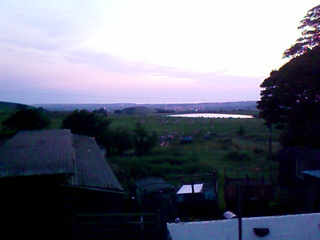
My room is upstairs, in the converted cow barn. It overlooks a farmyard that’s cluttered with tractors, dilapidated buildings, an old stable, a rusting shipping container or two, and all manner of equipment in varying states of repair and disrepair. Beyond are the rock-wall-lined fields where the young man and his dogs had herded the sheep. And beyond that, in the very distance, I can see the lights of St Bees and the silver ribbon of water that is the Irish Sea. According to Wainwright, this is the last I will see of that body of water on the C2C path.

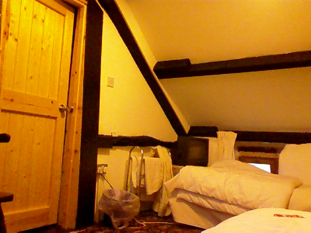
The house dates back to the 16th century in places. My room is in the hay loft of the old barn. Recently renovated, it’s very cozy all in white with old beams exposed and painted black. Downstairs is a lounging area with wood stove, warm rugs, and a cushy sofa that I curl up into with a cup of hot tea. There’s not a square corner in the place, and the walls are thicker at the bottom than at the top. White plaster is everywhere, with interesting beams and supporting members and flagstone floors retained.

I hang my clean laundry on the line in the back garden and go in search of Dorothy. I have been alone all day and feel an urgent desire for company. I find my hostess in the kitchen with her two Rottweilers and a cat that, like most felines, comes and goes as it pleases.

I sit with her at the kitchen table as we talk and she cooks my dinner—chicken and lots of vegetables, casaba melon as a starter, and strawberries with toffee ice cream for dessert.

The horses here are all shires. She has lived in this area most of her life—the farm was her family’s. Dorothy has always loved animals, and is skilled at animal communication. I ask her for tips.

“Forget about yourself,” she says. “Forget about yourself. Go inside, and ask the animal what they want—they’ll tell you. Touch them in rows of circles with your knuckles. You can find out a lot about where they hurt. They’ll look back at you when you’ve found a spot.”

The guests’ dining area is a glassed-in room that overlooks her front garden. On one wall is a color map illustrating the Lake District fells that are ahead of me; it presents them three-dimensionally, like an aerial-view painting.

I trace the hills I’m to go up and over during the next few days, and once again feel outfaced and a little panicky—I’m not ready for those yet. My baby right toe and number 4 left toe both are blistered—the left one badly enough I needed to pop it. I’m a little worried about how they will hold up, as favoring them could stress other parts of my feet and back. The base of my heels has skin that’s flaking off. I rub them twice a day with the patchouli oil that Patty gave me before I left. My heels feel hot when I stand on them too long. I’m already very glad I used the Sherpa Van service for my bag.

I tumble into bed that night to the sound of light rain and endlessly bleating sheep coming through the window in the slanted ceiling. Today I learned that when I feel lost, I should look at the resources I have instead of fretting over those I don’t have. I won’t be getting too far off track.

And the truth is that I always have just the right resources I need to find my way. If I don’t, they come to me—like that fisherman who showed up yesterday to lead me to Sandwith, the railroad workers who were there to point me back to St Bees, the farmer today who gave me directions as I walked through his Black How farmyard, and the locals who gave me a lift, a glass of water, the use of a toilet. And even when no one’s around, sooner rather than later, I spotted a landmark to get me on track—first I voiced the need for one, then the landmark itself appeared. It’s all been there for me the whole time.

This walk across England may be the hardest, most challenging thing I’ve ever done. What am I made of? What inner reserves do I have? I’ll find out day by day, road by road.

Trail miles: 8; actual miles walked: 12

Tuesday, July 18, 2006

C2C Day 1, Sandwith (Mile 6)—And So It Begins

I meet my first fellow C2C’er at breakfast this morning—Tracy from Seattle. She’s just finished a medical degree, landed a great job somewhere in the Midwest, and is at the beginning of a three-month vacation before hunkering down to her new career. She’s doing two UK walks, sailing in Greece, and taking a safari in Africa. An adventure holiday for sure.

I sit down to my full-English cereal, egg, bacon, tomato, and toast breakfast while she peels a hard boiled egg and butters cold, crisp toast. She’s mostly traveling with a girlfriend and just walked Hadrian’s Wall with her; for the C2C walk, she’s on her own before meeting up with her friend again. She’s done a lot of hiking in the US, especially around the Pacific Northwest mountains.

“My legs are holding up great,” she boasts. “It’s my feet that are the problem. Day-after-day walking is really hard on them. I’m babying a lot of blisters.”

We compare C2C itineraries. She’s finishing before I am, and will be walking the full 14 miles to Ennerdale Bridge today. As we look over our maps, I express my disappointment about the extra four-mile loop around St Bees Head, and about my compulsion to stick to it because that’s the “official” path.

“It wouldn’t be cheating to skip the Head,” she says. “You can do the walk any way you like.”

Blip. A light bulb goes on, and a great weight of expectation and anxiety lifts. I can do the walk any way I like. Even Wainwright had said that. It’s OK to take a different trail, to carve this path whatever way I might want to. Suddenly the idea of walking the added four miles is welcome, because I see it as a choice rather than an obligation. Another life lesson falls into my lap, and I breathe easier as I start out.

I finally get on the trail at 10:15a after a visit to the post office to mail the C2C map postcards. The entire beach looks different than it did yesterday. The tide is very low, and the water is very far away from where the toddler had spent an hour plunking rocks into the sea.

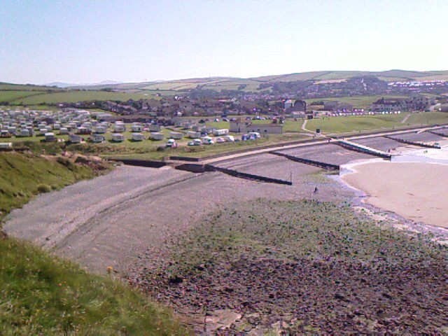
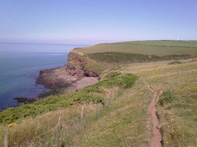
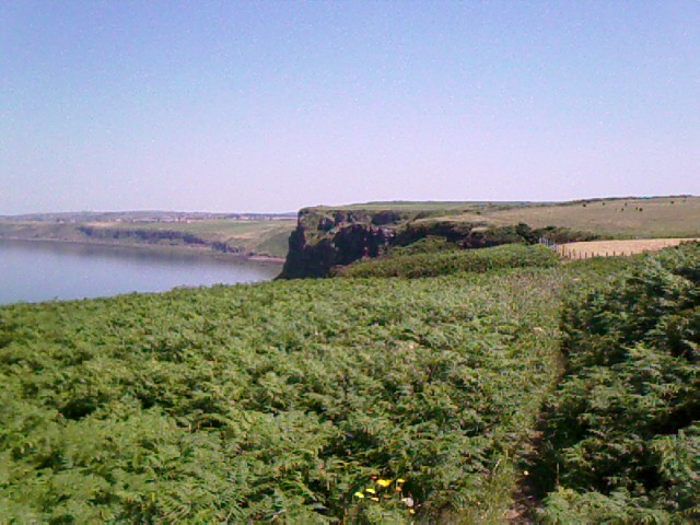
I climb the dusty cliff edge from the caravan park and follow an easy path with the Irish Sea at my left. The trail is reminiscent of the Southwest Coastal Path at Lizard Peninsula, only the coastline isn’t as ragged here. Cliffs drop off dramatically to thin strips of beach exposed by the tide. I don’t grasp how high up I am until I see a man and his dog romping down the strand. They seem like specks. The path feels uncomfortably close to the edge in places. The stiles are fewer, as well.

Deep, chest-vibrating booms roll over the sea every fifteen or twenty minutes, sounding very much like The Flying Dutchman calling for the Leviathan in Pirates 2. Probably a much-less-romantic naval practice session going on.

Sheep are often only a few yards away, grazing. Gulls, insects, and seabirds call. It is hot, with no breeze to turn my sweat into personal air conditioning. How can a coast have no breeze? Doesn’t wind always gust or waft or float or whip at the sea? I drink lukewarm water, mop my face, and yearn for the cooling winds of Cornwall.

Fleswick (“Flezzick”) Bay, at mile 1, offers a respite of cold water to soak my kerchief and a layer of cool, smooth pebbles to lay back on in the shadow of cliffs. I break for a brief snack and rest here, having followed a man and his young son—10, maybe 12 years old—down the gully and over slippery rocks. They’re also on the C2C, reading from the same Wainwright book I am as they take short breaks.

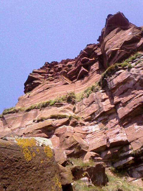
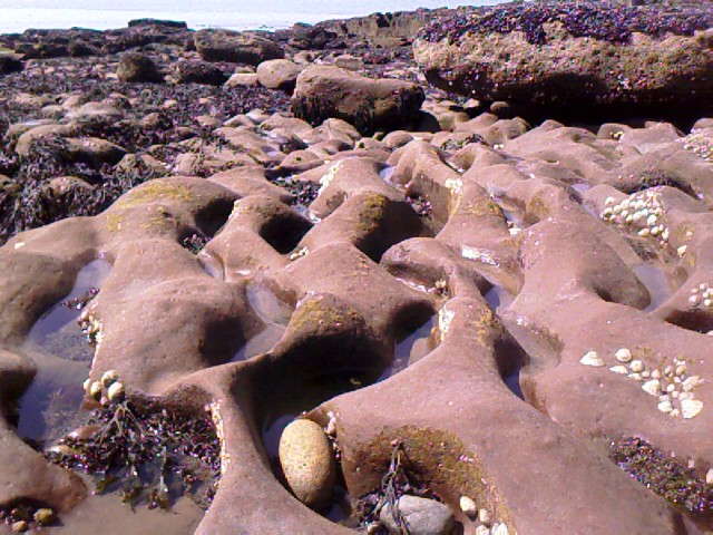
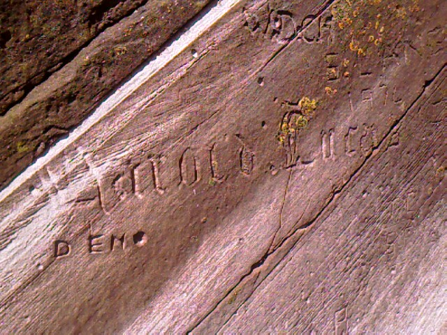
I am entranced by the tide pools here—brick-red sandstone eroded into rippled troughs. Water-made caves, big piled boulders, and names carved in stones with the skill of a fine typographer await my leaping explorations.

I decide to forgo a half-mile side trip to the lighthouse and Tarnflat Hall to keep the day short in the wilting heat.

Even with the foolproof concept of keeping the Irish Sea at my left, I mistakenly detour too soon off the grain fields that Wainwright describes, shooting south before I reach the disused quarry I should turn at. I begin to suspect I’ve gotten off track when a paved road I am on seems to be somewhere else on the map than where I actually am. My biggest landmark is a transmitter tower ahead of me—it’s on the map, but no intersecting gravel road also matches the one I’ve just come from.

While I try to get my bearings, a car drives up and parks by a chain-link fence around the transmitter’s field. A man gets out and grabs fishing gear from the back of the car. I accost him for directions and he points me straight down the road to Sandwith, a quick, if unremarkable, village to pass through.

As I leave Sandwith, my liter of water is gone, the heat of the day is at its height, and I am about a mile from the railroad tracks that lead back to St Bees. The path goes through the dairy yard of Desmesne Farm, where a fella is working on a noisy tractor. Two barking dogs come at me. Above the din, I point to my empty water bottle and pantomime for a fill from a hose.

Rather than merely point me toward a spigot, he shuts off the engine, calls off the dogs, and walks me down the concrete yard to the small kitchen of the farmhouse. I stand on the step while he fills both bottles with icy well water and lets me wet my kerchief. We chat a few minutes (he knows some folks in the US), I thank him and then verify directions past the last farms toward the tracks before heading down a shrub-lined road that offers the first, brief chance of real shade all day.

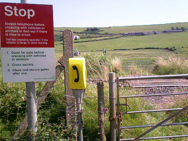
At last I am crossing the final cow pasture to reach a tunnel under the railway—my C2C stopping point for the day, a little under two miles outside of St Bees. Some men are working on the railroad, and they direct me back to town along a non-path that crosses cow and sheep pastures and edges a wood that Carole had told me about. I feel drained and headachy. I try to find a path into the woods, but barbed wire, fences, and rock walls surround it from all directions. I plop down in the shade of the trees at the edge of the pasture and lay down for a rest, carefully avoiding nettles and a few dried cow patties as I bed down in grass with my daypack for a pillow.

When I finally get in, I learn that I have just walked over eight miles through a heat wave of 28C (82F) in the shade—close to 90F in the open where I’d been all day. I have a big-time headache and mild heat exhaustion to show for it. I make mental notes for the days ahead: take twice as much water, have electrolytes, ditch the Elastoplast for wrapping my feet, and do the best I can with Bandaids and double socks to reduce the chance of blisters. I take a cool bath, drink more water, and nap for two hours.

Dinner is at The Manor House pub—trout rolled in oatmeal, chips, vegetables. So much food that I can’t finish it all.

Over supper, I read ahead in the Wainwright book and begin to feel seriously outfaced and uneasy about what’s coming up. He describes tomorrow’s trek over The Dent and, later, over the hills of the Lake District in ways that sound strenuous, dangerous, and rife with opportunities for taking wrong trails. Will my feet hold up? Will my legs hold up? Will I be able to follow the route and signposts? I got off track today on the simplest of trails. Sure, I got back OK. But I don’t like feeling lost.

“Not all who wander are lost.” –J.R. Tolkein

Richard had sent me that quote early in the trip. Well, sometimes those who wander are lost. And sometimes, as I was for a while today, they are lost and don’t know it. It’s at those times that ignorance really is bliss for me. Being lost and knowing I’m lost is the scary part—except that it does, I suppose, spur me to actively seek my way home.

It’s clear this C2C walk will challenge me—I can easily do the mileage one off. But as Tracy said, it’s the day-after-day miles that’s the trick. That, and this heat to deal with. Weather reports say the temps will be even hotter tomorrow, and could continue for a few days. Maybe I should bus to Ennerdale instead of walk. Or call the Sherpa Van people and ride with my backpack to the next B&B. Or walk only to Cleator and catch a ride the rest of the way. Better that than getting heat stroke by walking 10 miles in the same kind of conditions as today.

I turn in early, too exhausted to do more than consider a few other options and decide to see how I feel in the morning.

Trail miles: 6; actual miles walked: 8.5

Monday, July 17, 2006

The Buzz on St Bees for the C2C

I hate goodbyes. I nearly cried to say goodbye to Eric and the other horses last night at Torlundy, and was glad that Siobhan and Charlie hung around with me at the station to wait for the bus to Glasgow this morning. It delayed saying goodbye to them, too.

Siobhan invited me back, and is going to look up TTouch info. She seems pleased with the progress I made with Eric and Celene. I felt sad to be leaving them all, especially Charlie. I like his Taurus energy and unabashed, creative enthusiasm.

The gloriously sunny weather we enjoyed last week has left Fort William this morning. I face another travel day that starts out overcast and pale, but it warms and brightens by the time I reach Glasgow for the train south out of Scotland. Next destination: St Bees, and the beginning of my long-anticipated Coast to Coast (C2C) trek across England.

I use the time on the train for postcard catch-up. I am finally getting through the pile I’ve collected over the past weeks. I feel happy and relieved and like I’m surfacing from another cocoon. My monthly also finished yesterday, which I’m grateful for. I didn’t want to be dealing with that on the C2C walk.

The fellow across the table from me on the train is carrying a bottle of whiskey. He pours himself about two fingers neat, then pops open a half liter can of Stella Artois beer. He’s now looking zoned out with a headset on. The train is rocking quite a bit on this stretch of track. His scotch glass skates side to side on the table. The light amber liquid is pretty with the sunlight shooting through it.

I go to the dining car and must grab onto seats and handholds because of the rockin’ rails. On the way back, I meet a man and his 12-year-old daughter standing in the area between cars. The girl is peaky and sweaty, keeping her eyes closed and looking like she is trying hard hold her lunch as well as her balance. Dad is encouraging her to keep breathing. Motion sickness. I would be there too if I hadn’t taken a Bonine before I got on the bus today.

I’m feeling oddly happy to be leaving Scotland. Not sure what that’s about, considering the sense of belonging I first experienced on arrival. Perhaps I’m just finished here. I have less than a month left of the trip. I’ve been here two months already. Wow, two months. It seems like both a short time and forever.

Found a copy of Sky Burial in my bedroom at Torlundy last week and read it over a few nights. It’s about a Chinese woman who went to Tibet to find her missing husband and stayed there 30 years. My body tells me I’m on the verge of that kind of life—nomadic, unrooted, grounded only in Self. I feel scared and worried about it right now.

So much fear of inadequacy I still have around the idea of contributing gainfully to the world in ways other than through corporate writing. But now I see that that’s the same kind of awe and trepidation I once had around writing until I got into the industry. Not a paralyzing fear, really, but a bring-your-butterflies fear that can be my friend and guide if I let it.

I change trains at the Carlisle station, where I sit in a café with three other guests (one on a mobile phone in a corner, and a middle-aged couple stopping in for two medium-sized takeaway coffees), and listen to lyric strains of Enya’s Wild Child play between monotone railway announcements.

“Ever feel alive, and you’ve nothing missing? You don’t need a reason. Let the day go on and on.”

“Now arriving at Platform 1...Northbound train to Glasgow Central. Platform 1.”

“What a day, what a day to take to. What a way to make it through. What a day, what a day to take to...a wild child.” Da da-da da da-da...

Soon my own southbound train departs and we are winding along the west coast of England overlooking the Irish Sea. The weather turns hotter the farther south I travel, and sweat dampens my face as I heft my bag off the train at St Bees.

I am thrilled to discover that the walk to my B&B is the shortest I’ve had this whole trip. Barely one block after crossing the tracks, I find the street-side gate into Stonehouse Farm. Makes a dim memory out of that grim hike for lodging around St Austell a month ago.

As I dump my bags into the bedroom of the round-the-back, self-catering lodging that overlooks the facility’s horse-trekking stables, reality starts to sink in. I’m finally at St Bees, and the beginning of the C2C walk is finally here. Well, two days from now, really. I’ve booked two nights in St Bees, to give myself Tuesday to settle in, regroup from Torlundy, meander around town, buy the Wainwright/C2C book I want, and read all about the walk before I actually head out on Wednesday.

This fine intention is shattered shortly after my arrival. My proprietress, Carole, informs me that a heat wave is predicted for the next several days, and suggests that I split the first section of the trip, 14 miles to Ennerdale Bridge, into two days. She also tells me that I’ll need to walk the first four miles of the trail around the whole head of St Bees—an extra bit of path I hadn’t anticipated.

“What, I don’t just go to the sea and start walking due east out of St Bees?”

I root out the Footprint maps I bought weeks ago in London to check the veracity of her story. Damn. It’s corroborated. Four miles of coastal walk that actually heads me west and north before looping back east and passing through a place called Sandwith. Carole pronounces it “Sennith” and says that the railroad tracks beyond the village should be my destination for tomorrow, which puts me at mile six on the trail. It also puts me at a spot that adds more than two miles just to get home from the first leg, then the same two miles retraced to return to the trail on Wednesday. Rowr. Already I’m not particularly liking this business—I expected the path to be a little more straightforward. And a heat wave, too. Damn. I’ve already been reminded at Jura that heat, hiking, and I don’t mix well.

I unpack and head for the coast to scout out the caravan park that marks the beginning of the C2C trail. The beach is about half a mile from the B&B. OK, so tomorrow’s hot, six-mile hike is already adding up to nearly nine miles. I try to let go of the crankiness this raises.

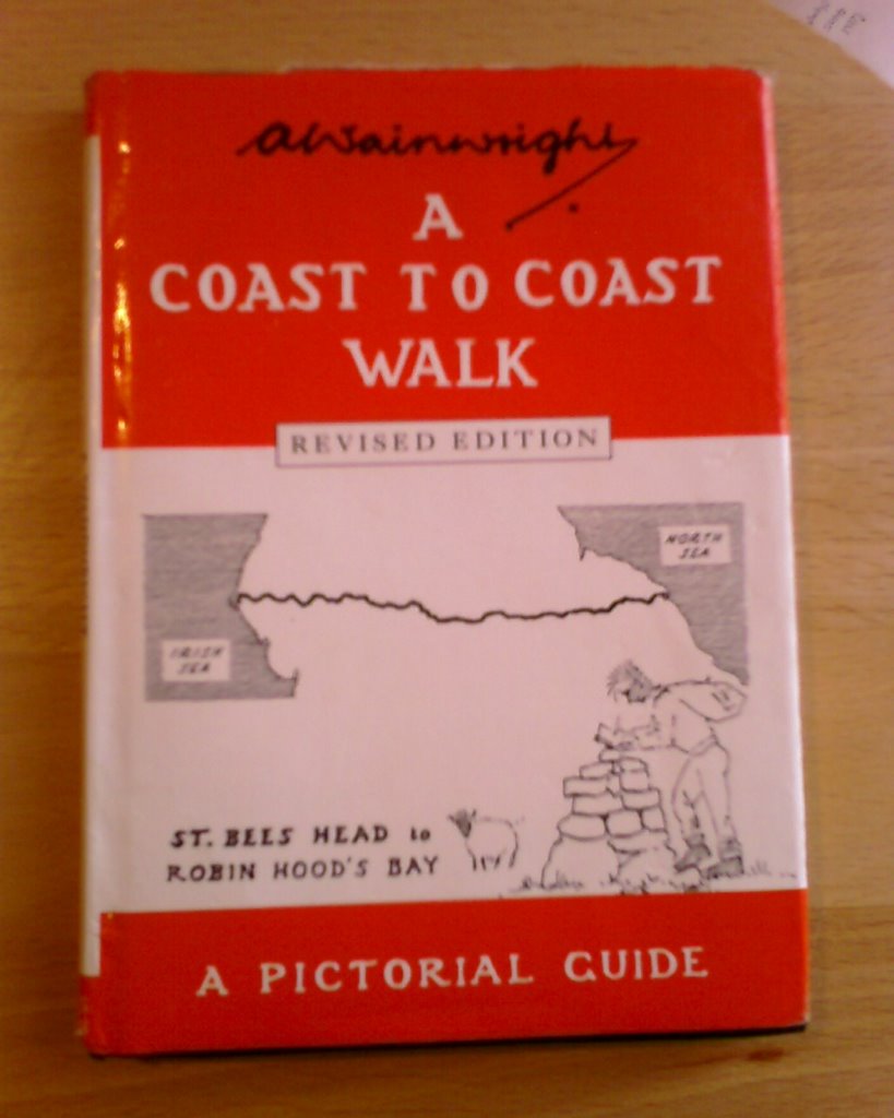
Ice cream helps. I duck into the beachfront shop for a double-decker chocolate and honeycomb crunch on a pointy cone to go. I also buy their last copy of the quintessentially quaint C2C book—A. Wainwright’s A Coast to Coast Walk: A Pictorial Guide. They have the revised edition.

It’s pocket-sized, which I like, and full of pen-and-ink illustrations and descriptions written in Wainwright’s hand. He’s the one who pieced together the walk, spending many years criss-crossing the country and a year writing up his favorite trails so that others could follow the path. That was in 1973. It’s one of many books he’s written about walks through his most beloved part of England.

I try not to drop the ice cream as I slip his book into a slim paper bag along with a few postcards that illustrate the C2C path and stops I’m about to take for the next 19 days. I’ll mail them to a couple of friends back home with my itinerary, so they can track my progress.

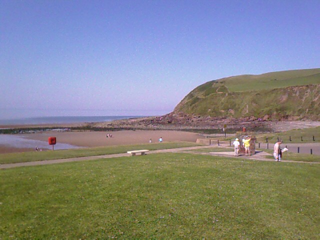
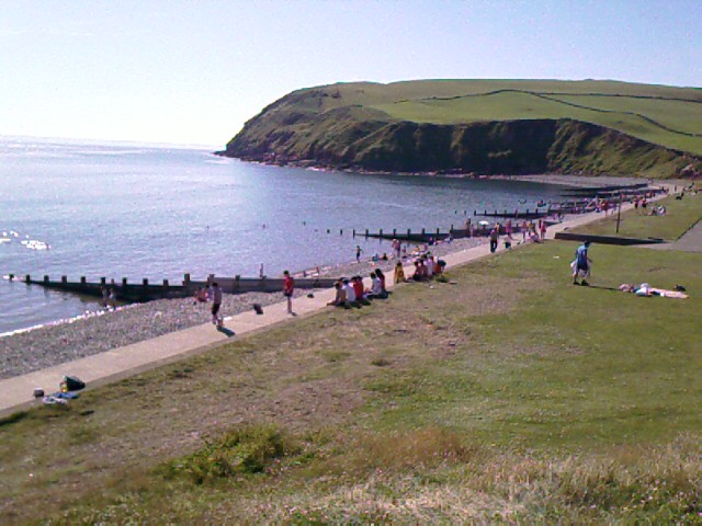
Outside, my ice cream melts rapidly in the heat, and I use an extra paper bag as a napkin (“serviette”) to wrap around the cone. I sit on the grass outside the shop and people-watch across the beach’s lawns, cement boardwalk, and water play areas. Not many people are here today, but it’s the usual beach fare. Picnic blankets and sunbathers, swimmers and splashers, tots screeching over dropped ice cream, teenage boys butting around footballs, a row of friends talking on the stone wall. Only instead of the sand that I’m used to, there’s river rock and gravel because the tide is so high. In the distance, St Bees Head curls toward me around the bay.

I watch children and teenagers run around in swimsuits and shorts and skimpy tops with what seems like total unself-consciousness. I lament the loss of that freedom in my teens, when, like so many of my peers, I became uncomfortable with my body, embarrassed by it. That restrictive Baptist high school, plus messages I got at home. I recall a magazine article I read at Torlundy about body image—that women are more sexually attractive if they like all of their bodies.

I see what they mean. Not every girl is model thin or beautiful here, and it doesn’t seem to matter. Teenagers wear midi tops over thick, rounded waists, and skin bulges over the tops of their jeans. No unpadded bones stick out at hip or shoulder. I see no attempts to suck everything into starved nothingness, no signs of competition for the thinnest, sexiest body. Even middle-aged, fleshy bellies sport belly button rings and flow out like a Rubens painting below bra-like tank tops. How refreshing to be at a beach where women seem to neither hide nor flaunt their skin or their body shape.

The tide is close in today. I walk along the sidewalk to the stony beach at the base of St Bees head. I sit with my legs outstretched on warm smooth rocks and watch a diapered toddler pick up stones—some of them very big for his size—and dump them into the water. Kerplunk! He giggles, squeals, waves his hands. Picks up another. Kersplash! More laughs, more hand waving. He plops his bum down into the sea to reach another rock. A big flat one. Another overhand throw that flips from his elbow like a fore-shortened catapult. Another hollow, satisfying kersploop! into the shallows. His disposable nappies are so wet from the sea that they sag as if his middle were wrapped in bread dough. He is oblivious and content.

I seek out a special stone among the hundreds around me. This is a ritual of C2C’ers—to carry a small rock from the Irish Sea at St Bees and toss it into the North Sea at Robin Hood’s Bay almost 200 miles away. I am reminded of the Aesop’s fable about the thirsty crow that drops rocks into a pitcher until the water level is high enough for it to drink. How remarkable that all of us C2C’ers are actually removing and creating coastline, one stone at a time.


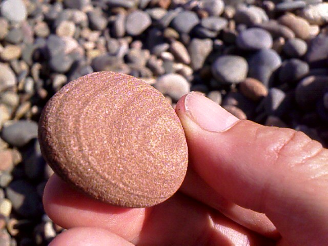
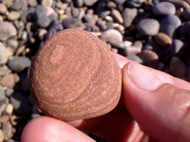
I pick up a few stones. Feel them in my hand. Wonder at where they came from. Naw. Not this one. Not this one either. I settle on a rosy sandstone that’s local to this area, with rings like water on both sides. Watermarks for each coast.

I’ve wanted to do this C2C walk for three years, since first reading about it in a Smithsonian magazine in 2003. As early as 1999, I’d earmarked this year’s summer to be spent in Britain, and reading the article crystallized an important part of the trip. It is to be my ending anchor point, just as my London stay and TTEAM training week were my beginning anchor points.

After arranging my airline travel, planning the walk itinerary and overnight stops was the first thing I did from home. The C2C is an unguided walk, with no set schedule to follow except what each walker wants to do. It seems that most people take about 14 days, the average vacation period for Americans. I decided on 19 days, which includes a day of rest in the middle at Keld.

I figure this will give me lots of time to take in the views, not hurry, and go easy each day. My longest day is 16 miles, instead of the typical 20, and I’ve got one day near the end that’s only six miles. This means I’ll be slowing down, instead of rushing and pushing, as I reach the end of the walk. I’ve also booked an extra day at Robin Hood’s Bay, so I can soak in my accomplishment instead of running off to the next thing on the travel agenda. Which, at this point, isn’t defined yet, anyway.
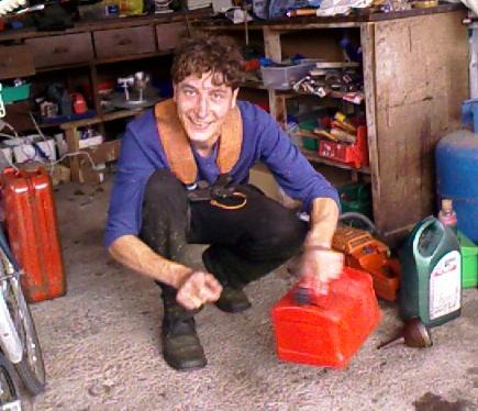
Having hauled my backpack with me for the past two months, I am particularly glad that Sherpa Van, the company I used to arrange my C2C bookings, is driving my luggage point to point for the next two-plus weeks. I’ll just carry a daypack with lunch, water, maps, and trekking poles. It seems a bit of a luxury expense now, but I know I’ll welcome it later.

Beyond reading a few snippets of other people’s experiences on the walk, I deliberately broke my pattern and didn’t do a lot of research to prepare for the C2C. I didn’t buy every OS map while in the US and plan every detail of the route ahead of time (although I thought of it). I didn’t take a crash course in orienteering to learn every nuance of compass reading and tracking (although I brought a few cheat sheets on it). I didn’t order and read the Wainwright book ahead of time (although I idly sought it out in London bookstores). I didn’t even crack open the C2C Footprint maps to study them until today. I know almost nothing about this path except what that Smithsonian article said and what I gleaned from the Sherpa Van website.

This feels both scary and daring to me. And a little bit stupid, given my old belief that I must plan everything to the nth degree to keep anything from going wrong.

But like so much on this trip that I have avoided planning for, I want to be completely open to what’s on this path ahead of me. I don’t always do so well with surprises that change my plans (as I note my lingering crabbiness over the extra miles to be gained by splitting Day 1 into two parts). I also have a deep fear of getting lost—a big life issue that I know I’m looking metaphorically in the eye.

My one security is knowing that I have lodging waiting for me every night and that, because of that concession to planning, someone will be looking out for me in case I don’t show up of an evening.

The rest I’m leaving up to the universe, daily perseverance, and, I hope, good signage and meeting other friendly C2C’ers along the way.

Sunday, July 16, 2006
Horses, and Fishes, and Pigs, Oh My!

For me, there’s nothing like settling into a routine on a farm to let the days ease by, especially if it involves being anywhere near horses, tack, and barns. I can spend hours at a stable and never feel the time pass.

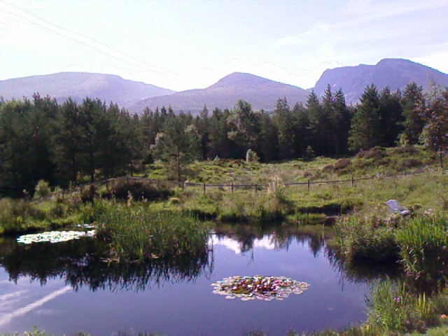
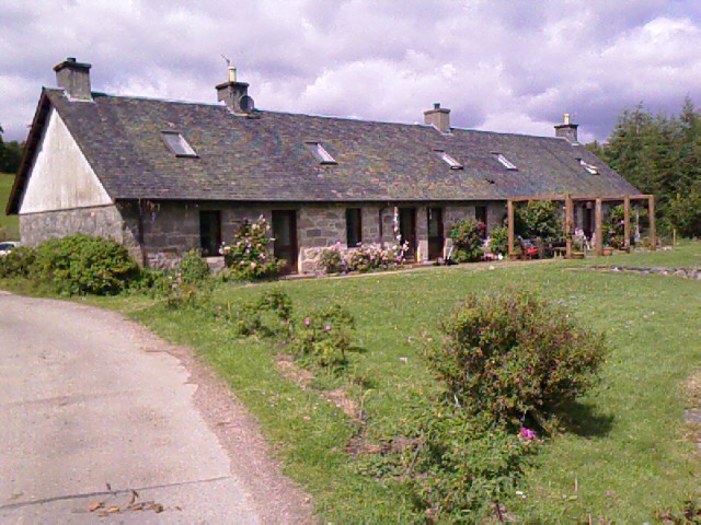
Torlundy Farm is an amazing place. It covers over five hundred acres of fields, woods, brooks, and hills. It is practically at the base of Ben Nevis, the highest mountain in Britain, over 4,400 feet. I didn’t see its top for three days because of cloud cover.

Legend has it, according to Charlie, that if the one particular spot of snow on the side of Ben Nevis ever melts, it will signal the end of the world. I check each day to make sure the snow is still there, especially as hotter days burn the clouds off toward the end of the week. I proposed to Charlie that maybe someone has painted the white spot on the side of the mountain so people don’t lose faith, like in that O. Henry story about the man who paints a leaf on an ivy vine to prevent a sick woman from dying when the last leaf falls. Charlie just rolled his eyes at me and grinned.

Ben Nevis and its two companion mountains, Carn Mor Dearg and Aonach Mor, are visible over the front garden from the window of my large private bedroom. The evenings are deep-blue sky. In the middle of one night, I woke up to moonlight flooding across my bed. There’s no sight like a full moon over Ben Nevis. I’m sad that Perry’s camera couldn’t capture it.

My first few days here were spent under Siobhan’s instruction about the animal feeding and horse routines, coupled with stall and tack cleaning, general farm chores, helping Chris with some computer problems, and grokking the reservation process for the chalets. I’m glad that Charlie has done that part before.

Siobhan took me on several horseback rides over hills and through shady glades on trails that are in almost constant view of Ben Nevis. We were checking on the horses or sheep, or taking a chalet guest for a ride. I haven’t ridden much for about two years, and have ridden the same horse for seven, and I felt really out of shape and clumsy riding the different horses from Torlundy. Trail riding takes a different kind of confidence in the horse and myself than arena riding, and I could tell it’s not a confidence I’ve cultivated yet.

Mealtimes for the first two or three days united the entire family around the kitchen table over home-cooked food. Breakfasts had farm-fresh eggs (when we could get to them before the dogs did) and lunches and dinners had home-grown salad greens and organic foods bought from a tightly-stocked local grocery store outside of Fort William.

Siobhan and the girls are all wonderful chefs, and over the week I enjoyed a smorgasbord of from-scratch cheese soufflés, stew, and Thai food in between my favorite piece-together lunches of cheeses, meats, bread, and salads. I kept expecting (and hoping for) leftovers, but everything goes into the slop bucket for Miss Nicolette, including her daily dose of caffeine in the form of used coffee grounds and tea bags.

Daisy and Gemma left for their respective points east and south in Glasgow and London Tuesday, and Siobhan and Chris headed for London on Wednesday night. In their absence, Charlie and I fell into an easy routine of animal and yard chores. I took care of the animals and he took care of the yard work and “strimming” (weed-whacking using a string trimmer, or “strimmer”), and we both managed the phones for the guest house reservations.

Charlie is great fun to be around—27, delightfully energetic and artistic (ask him about his lawn sculpting with a strimmer), with a brilliant mind for details, history, song, humor, and theatre. He has a willing heart and willing hands, and is thin as a strimmer himself.

He’d spend all morning in the gardens near the house with the strimmer, then disappear for hours on the tractor to mow acres of fields somewhere in the Scottish outback that’s the Carver property. I usually took care of the cooking or lunch prep, and Charlie was tops in adulation over the meals.

Thursday brought some excitement with helicopters all over Aonach Mor next to Ben Nevis. A gondola on the lift that goes to a restaurant halfway up the mountain had somehow collided with another one and fallen. It felt weird to watch the rescue activity from the driveway of Torlundy. Radio reports were sketchy. We found out later that no one was killed, although several people were flown to hospitals.

Charlie drove every day to Fort William to buy three to four local newspapers for their crossword puzzles. We’d spend lunch or dinner grappling with one puzzle, getting stuck, and moving to another. I cleaned the huge red-enamel gas stovetop one night with almost no effort because we were laughing so hard over mystifying crossword clues and Charlie’s horrible spelling, which often produced far more creative answers than the puzzle writers had anticipated.

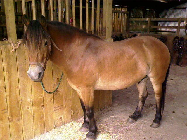
Working with Eric and Celene this week was both challenging and satisfying. Eric, pictured here, is an Exmoor pony who’s skittish about things coming at him from both sides, can be hard (as in last) to catch, moves away from anything near his feet and legs, and jerks away if someone reaches for the top of his head. I wanted to see if I could help him be more comfortable and confident in the world. Celene is a young-adult horse, and Siobhan had asked if I could help her be less head-shy with haltering and bridling.

I worked with both Eric and Celene using TTouches and techniques that I learned at the TTEAM training in Farmborough (sheesh, was that only a month ago?). I enlisted two young guests from the chalets—Tanya and Shaunie—to help me guide the horses through a labyrinth and other ground exercises a couple of times a day.

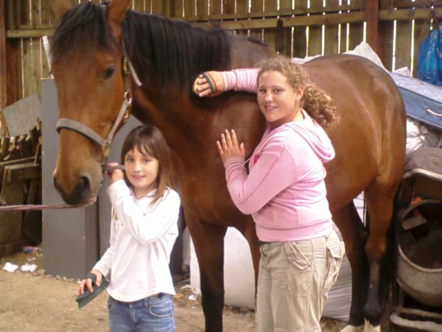
Tanya and Shaunie were both very good at learning the TTouches, and were a tremendous help getting Eric used to more skin contact. That’s them grooming Chris’ horse, Great Glen, in the barn.

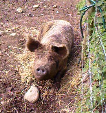
Even Nicolette loved the TTouch. I’d lean over the fence of her sty and she’d move around on her wooden feeding platform to present first her butt, then her head, then turn around at my request so I can do her other side. Her hair is wiry and her skin is wrinkly, but softer and warmer than I expected. And those ears are so big I could put my whole palm on them for stroking. She liked having her jowls TTouched, too. I’ve never gotten this chummy with a pig before; I liked the opportunity as much as Nicolette seemed to like the TTouch.

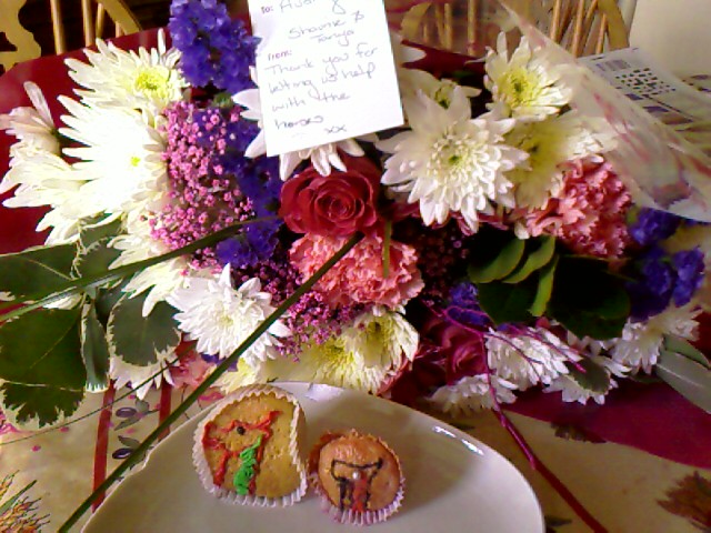
After our last TTEAM session on Friday, Tanya and Shaunie surprised me by coming back from the chalets with a gift of flowers, homemade cupcakes, and a lovely thank-you note for letting them help with the horses. They were indeed a great help to me, for Celene and Eric were both showing remarkable progress since we started with them on Thursday. By Saturday, I was able to halter Celene without her turning away, and Eric was not only coming in ahead of the rest of the horses, but was also OK with things all around his sides, and open to having his legs and feet touched without moving away.

Siobhan arrived home in the morning on Saturday, and I helped Liz, their chalet housekeeper, with some of the cleaning to get the chalets ready for the new guests.

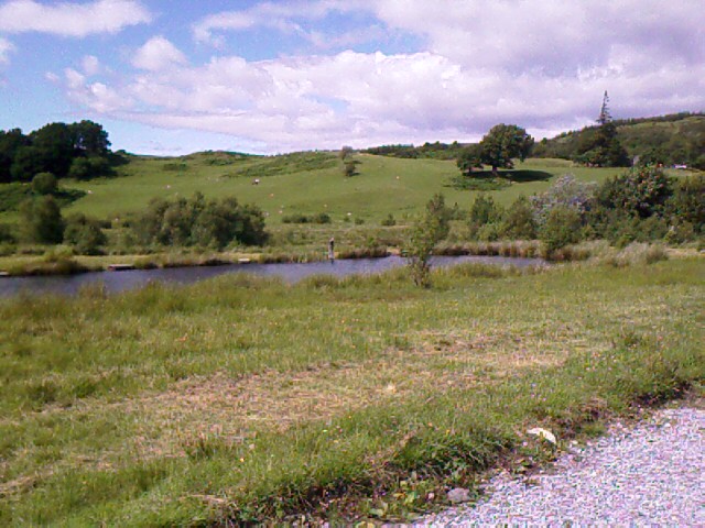
Saturday afternoon lazed by as a picnic with Siobhan and Charlie at River Lochy, a primary salmon run whose banks demark a border of the Carver property. Siobhan explained that many rivers in Scotland have strict fishing rights and regulations. This one is fishable for trout, and only for fly fishing.

Siobhan took us to the river in her truck, driving straight through several seat-jouncing sheep fields and parking under a tree next to a barbed wire fence. We covered the fence with cushions, handed over picnic basket, wine, blankets, and other goodies, and climbed down through bracken to reach a sandy, half-shaded beach.

The day was hot. The water was cold. I swam across the river (another first for me, like the loch swim at Jura). We slathered melting Flora margarine over bread and crackers, peeled off slices of warm salami and cheese, ate olives and salad greens, nestled wine glasses in the sand to hold them up, and talked and laughed and napped in the sunshine.

On the way back, Siobhan gave us a driving/historical tour of the Fort William area on both sides of the river, including many views along the Caledonian Canal that runs from Fort William to Inverness. Neptune’s Staircase is here—eight locks to navigate through the elevation change of the canal. Sometime I’d like to grab a friend and rent a canal boat to travel part of the UK this way.


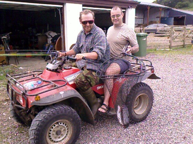
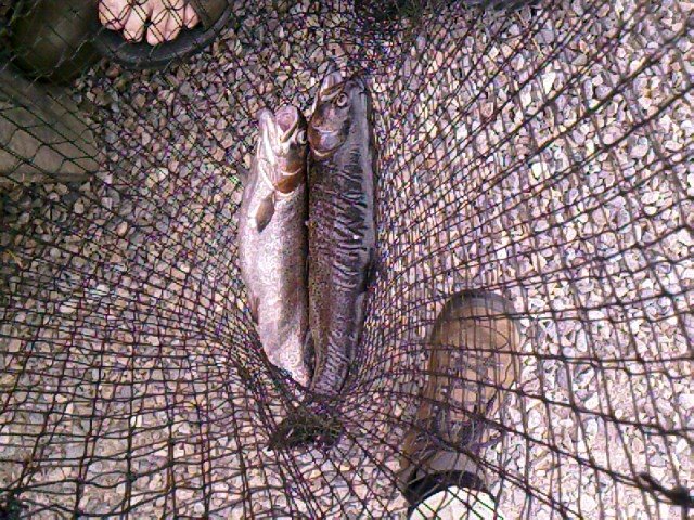
I had been invited all week by Ian, Torlundy’s almost-resident ponds-keeper, to drop in for a free fly fishing lesson, and I finally took the time out on Saturday to do it. Besides teaching fly fishing, Ian manages the catch records, trout stocking, and fishing fees for the three ponds on the property. That’s him driving the ATV with a guest who caught two large trout in the upper lake.

Now let me begin by saying that my only other foray into fishing was almost twenty years ago, with Richard on the Snohomish river in Washington. We had brand-new gear, freshly minted fishing licenses, and no idea what we were doing. We somehow found our way to a part of the river where no one else was fishing, and where the water ran rapidly over some rocks. I snagged a 4-inch fish, which was so under the size limit that the thought of having it for dinner gave a whole new meaning to “small fry.”

The only other catch of our day was also mine, and it put up a bit of a fight against the current and over the stones. I was already salivating for supper when my prize cleared the water—a sodden, black leather work glove. Richard and I guffawed, and he unhooked it and flung it away behind us. When it landed in the bushes, the glove was palm up, with only its middle finger extended to give us the bird. Years later, we sold all that brand-new fishing gear in a garage sale.

With this redoubtable record, I wasn’t particularly hopeful about fly fishing, but decided it was worth trying as something new. I arrived at the pond about an hour before sunset, and the water was quiet and still. Even the midges weren’t biting. Ian was happy to put a pole in my hand and explain the nuances of the toss and the fly and how the fish respond to it in the water.

Ian is a good teacher. Because I was a beginner, he had me use repeated tosses to get the fly way out into the water, instead of trying for a long-range throw all in one shot. Within only a few minutes, I could do a few semi-decent casts that actually reeled line out and sent the fly away farther each time. Consistency was harder to achieve.

I found out a lot of ways that casts don’t work. Sending the rod too far back over my head meant that I’d hook a wad of meadow grass and fling it—plop!—into the water, no doubt scaring every fish in the pond. I could just hear them muttering to each other below, “Hey, man, stay away from that dock. There’s some big sh!*&^# comin’ down!”

Part of the trick was knowing when to release the fishing line from where I pinned it under my finger during the throw. If I released too soon, the line would whiiiinggg straight up into the air and the fly would drop down almost on top of me. It I freed it too late, no fresh line would reel out, the fly would snap-stop in mid-air, and the whole would plummet straight down—kerplunk—creating a watery ripple of “Oh, god, another amateur” spreading outward over the pond.

Ian, of course, could consistently send the fly arcing up and over with one graceful throw that spun out yards and yards of line in a satisfying whir and never got snagged on anything. Years of practice does that.

Thirty minutes later, Ian and I were still casting from our respective little docks at the edge of the pond. I was enjoying the relaxing rhythm and companionable silence. Fly fishing is one of those sports that’s enjoyable even if nothing more happens than flinging the fly through the air. I like the soft whizz of the reel feeding out line, the gentle plink of the fly landing in water, the subtle V that forms on the surface when I drag the lure back in. Being pond-side and in the open air seems to be enough.

Just as I was feeling the fatigue of continuous casts and ready to stop, Ian hooked a trout and called me over so I could reel it in. He taught me how to let it play out the line, then to pull it in steadily for him to scoop up into the net. It was a lovely shimmery thing, maybe a foot long, full of whipping muscle and gaping mouth and gills. I couldn’t bring myself to cook it for supper, so we let it go free back into the pond. I’m officially recorded in the log as someone who did a catch-and-release.

Sunday, my last day at Torlundy, I taught Siobhan some of the TTEAM basics with Eric, and we worked with 2-month-old foal of a mare named Jura (there’s that Jura again).

Siobhan thinks I should continue with the animal work and WWOOFing. She says I’m good at working with animals. I agree. This week has taught me that I really like farm environments, and that I prefer to work with animals much more than with plants, although I can still take or leave dogs. I have so much to learn about working with horses, too—young, old, different breeds and sizes.

Siobhan commented on Sunday that Eric was “much easier to catch; he doesn’t walk away from me anymore,” which I was very glad to hear. I felt I’d done well by Eric, the WWOOFing program, and the Carvers’ generous hospitality.