While my Orton B&B hosts may have left my in-take experience something to be desired, they make up for it with breakfast. They work as a team to feed a dozen of us at once in two rooms—the glassed-in patio and the front family room. I eat in the family room with Michael and David and a couple I haven’t met before. The breakfast is as good as they come, and my hostess packs a huge lunch for me before I go.
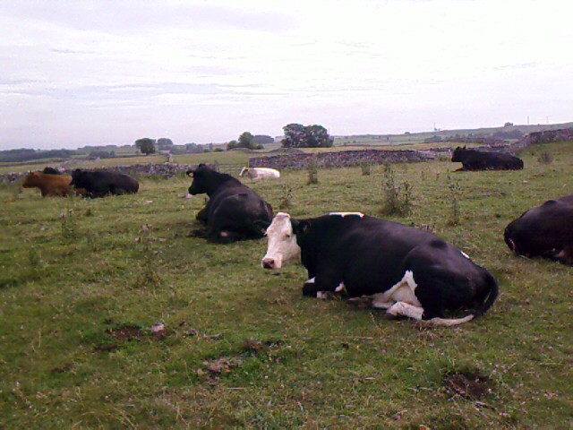
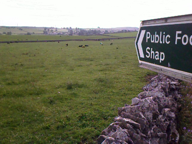
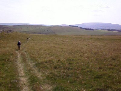
 I leave Orton/Raisbeck at 8:25a and am quickly caught up by Michael and David just outside the stone circle that marks a right-hand turn onto four miles of moors. Today turns out to be a level walk overall, with 12 miles of mostly undulating grassland and prickling grass and thistles. We travel to the sound of baaing sheep, buzzing insects, and mooing, heavy-bodied, heavy-uddered cows and meet only a few people on the trail.
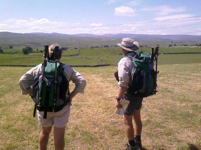
 The Pennine mountains slowly grow bigger ahead of us and the Lake District hills slowly grow smaller behind us. I look back on the trail today and marvel that I’ve actually walked from the other side of those hills.

 The day is hot and breezy on the high spots, hot and still on the low spots. The temps have remained in the upper 20s (28C=82F) and are supposed to reach 30C today. The trail is mostly obvious, with only the occasional need for map checks on the moors, which swallow footsteps into trackless land. Stone walls are almost always on our right or left to act as our path guides.
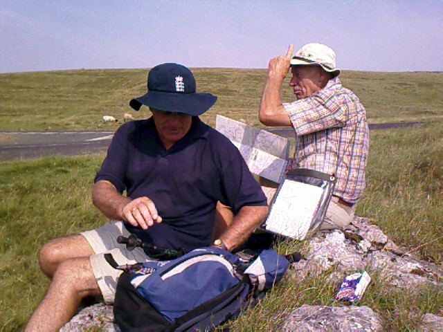
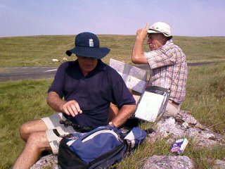 It is over one of those moors that I learn OS Map Rule #3: Follow the map, but remember to check it against reality. Michael, David, and I had merrily followed a path through heather and grasses and come out at a road as expected. The map said to jog left to the north, then hairpin south at a V junction in the road. However, the actual trail, trodden by hundreds of boots before us, had diverted from the mapped path and taken us south to the V junction itself, and I hadn’t noticed it. Ignoring what the roads looked like, I was ready to direct us up the hill to find an intersection that doesn’t exist. I’m glad Michael did a backup map check while we rested.


 My body today feels strong and healthy in heart and lung, and my legs are getting stronger for sure. My feet are holding up well overall, my left ankle is good despite my fall in that rabbit hole two days ago, but wow do my knees feel every downhill step, especially on the steep track we take down to Smardale Bridge.

This bridge seems to stand in the middle of nowhere in the distance, as if it once had a greater purpose than it does now. Which is probably true, in that people probably crossed it to get to the now disused railway and quarry nearby.

 When we finally get close to the bridge, I laugh out loud. Clustered under it are a handful of people, every one of them doing the same thing I’m fantasizing about—getting out of the blazing heat and dangling their bare feet in the brook. Michael, David, and I clamber over a rickety wooden fence to join them and eat lunch. Their group is so big that there’s no room left under the bridge; we sit in the sun, but our feet are in the water. I find home-baked cinnamon and gingerbread cookies in my packed lunch.
 The others under the bridge are folks I haven’t met yet on the trail. Most of them are in their twenties or thirties. They soon finish their foot soaks and depart for the trail. We take over their space in the cool shadow of the bridge. Small, dark fish dart around our feet, and they begin to nibble my toes. It tickles, and I let them do their plecostomus act, working at my skin like those fish that clean the algae off aquarium glass. These fish must like whatever juice my feet produce, for my toes come out very clean.
 This area, according to Wainwright, is particularly rich in mostly unexplored archeological finds. The clear remains of the Severals Village Settlement are next to the bridge. And “giant’s graves”—long “pillow mounds” of earth visible on the hillsides after we leave the bridge—remain a mystery as to their origin and purpose. Michael likes reading the history here and pauses to take photos of the mounds that little Perry can’t zoom to.
 The walk continues easily from Smardale Bridge over more and more flatland. We come across a herd of cows who walk along with us for a stretch, and pause to watch four sheep dogs and a man on an ATV herd sheep into a pen for dipping. ATVs are big here for all kinds of farm and ranch work, and for zipping into the nearest village to run errands.


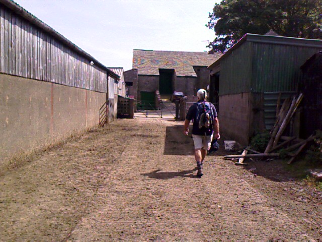
 Our last bit of road today is the most harrowing: after walking through another of those farmer’s dairy yards, we get squeezed into a hedgerow by a milk tanker coming at us down a single-lane path. He can’t back up, and we can’t go anywhere but into the bushes. We all press deeply into the hedge, and I feel a fence stop my backpack. I tuck in my toes, the driver slows to a crawl, and the long tanker flows by us, its silver surface reflecting the scene all out of proportion like some bizarre fun-house attraction on wheels. We all laugh, give him a wave, and head out toward residential streets.
“Now which way into town?” asks David, just as I spot a pointer sign in someone’s front garden: That way to town. I laugh: “Ask and ye shall receive, David!”
We stop a couple of teenagers for directions to the hostel (for me) and the campground (for Michael and David). The sites are in opposite directions, and we part company with plans to meet for dinner at the Wainwright Chip Shop, where we’re also supposed to sign the official en route C2C book.
The YHA rooms aren’t open for use yet, but my bag has arrived. I drop my gear with it and go out for a look around town. I hear my name called and turn around. John and Elaine are coming down the sidewalk on their way to their hotel, where Jenny and Len are also staying. We exchange greetings and travel notes (we were apparently leaving Smardale Bridge just as they were coming down the hill to it), and they’ve heard about a good pub to go to—the Black Bull. We agree to meet for drinks at 6.
 I had planned to spend one night in Kirkby Stephen (pronounced Kirby Steven) and two nights in my next stop, Keld, for a day of rest. Upon seeing Kirkby Stephen, however, I decide to change plans and take my rest-day here instead. The town’s YHA is ideal for a break—a big converted Methodist church (complete with a stained glass rose window); it has wooden pews and huge tables for the dining area and full laundry facilities. It’s near the post office, so I can mail away stuff I don’t need, and it allows hostelers access during the day, which means I can have a comfortable place to work on my journal and scrapbook on my day off. I’ve also been told that Keld is a very small village, with few to no amenities, including no post office, and no bank. I’m running low on cash and most of the B&Bs I’m in don’t take credit card, so a bank run is a must. Besides, John and Elaine are also staying an extra day here, which means we might be able to travel to Keld together.
The fish shop where David, Michael, and I are to eat tonight is at the far end of town, but the place is closed on Tuesdays (today) and Wednesdays. So no chance of signing that C2C book, after all. I call David and Michael to break the news. David answers his cell phone while he’s in the shower(!), and we agree to meet the others for dinner at The Black Bull.
I return to the hostel feeling exhausted. I sprawl out on a sofa near the dining room and fall fast asleep. An hour later, I wake to find a pile of huge backpacks collected near mine, but no one around. It’s almost check-in time, and I’m first in line for a ladies bunkroom—the “Aisle” next to “Altar”—that ends up being almost empty both nights I’m here.
 I eat dinner with all my friends at The Black Bull amid much laughter and a bit of sadness for me—this is the last night everyone’s itineraries match, and it’s farewell for me to four. Michael and David finish on Aug 2, John and Elaine on Aug 3, Jenny and Len on Aug 4, and I on Aug 5. Only John and Elaine’s schedule matches mine for a couple more days. Michael, David, and I promise to e-mail photos and to text each other messages of our progress.
I wonder who else I’ll meet in the slower days ahead, and I feel a familiar insulation close around me. I’ve built friendships by walking common ground, often on very challenging terrain, from the start of the walk. I’ll be starting that friend-building process again on the second half of the walk, quite possibly with new groups that have already formed. I’ve also given some thought to what comes after the C2C, and have decided to stay in one place for five days or so before returning to London for my last few days of this amazing holiday. Where that “one place” will be is still up for grabs.
 I leave Orton/Raisbeck at 8:25a and am quickly caught up by Michael and David just outside the stone circle that marks a right-hand turn onto four miles of moors. Today turns out to be a level walk overall, with 12 miles of mostly undulating grassland and prickling grass and thistles. We travel to the sound of baaing sheep, buzzing insects, and mooing, heavy-bodied, heavy-uddered cows and meet only a few people on the trail.
 The Pennine mountains slowly grow bigger ahead of us and the Lake District hills slowly grow smaller behind us. I look back on the trail today and marvel that I’ve actually walked from the other side of those hills.
 The day is hot and breezy on the high spots, hot and still on the low spots. The temps have remained in the upper 20s (28C=82F) and are supposed to reach 30C today. The trail is mostly obvious, with only the occasional need for map checks on the moors, which swallow footsteps into trackless land. Stone walls are almost always on our right or left to act as our path guides.
 It is over one of those moors that I learn OS Map Rule #3: Follow the map, but remember to check it against reality. Michael, David, and I had merrily followed a path through heather and grasses and come out at a road as expected. The map said to jog left to the north, then hairpin south at a V junction in the road. However, the actual trail, trodden by hundreds of boots before us, had diverted from the mapped path and taken us south to the V junction itself, and I hadn’t noticed it. Ignoring what the roads looked like, I was ready to direct us up the hill to find an intersection that doesn’t exist. I’m glad Michael did a backup map check while we rested.


 My body today feels strong and healthy in heart and lung, and my legs are getting stronger for sure. My feet are holding up well overall, my left ankle is good despite my fall in that rabbit hole two days ago, but wow do my knees feel every downhill step, especially on the steep track we take down to Smardale Bridge.
This bridge seems to stand in the middle of nowhere in the distance, as if it once had a greater purpose than it does now. Which is probably true, in that people probably crossed it to get to the now disused railway and quarry nearby.

 When we finally get close to the bridge, I laugh out loud. Clustered under it are a handful of people, every one of them doing the same thing I’m fantasizing about—getting out of the blazing heat and dangling their bare feet in the brook. Michael, David, and I clamber over a rickety wooden fence to join them and eat lunch. Their group is so big that there’s no room left under the bridge; we sit in the sun, but our feet are in the water. I find home-baked cinnamon and gingerbread cookies in my packed lunch.
 The others under the bridge are folks I haven’t met yet on the trail. Most of them are in their twenties or thirties. They soon finish their foot soaks and depart for the trail. We take over their space in the cool shadow of the bridge. Small, dark fish dart around our feet, and they begin to nibble my toes. It tickles, and I let them do their plecostomus act, working at my skin like those fish that clean the algae off aquarium glass. These fish must like whatever juice my feet produce, for my toes come out very clean.
 This area, according to Wainwright, is particularly rich in mostly unexplored archeological finds. The clear remains of the Severals Village Settlement are next to the bridge. And “giant’s graves”—long “pillow mounds” of earth visible on the hillsides after we leave the bridge—remain a mystery as to their origin and purpose. Michael likes reading the history here and pauses to take photos of the mounds that little Perry can’t zoom to.
 The walk continues easily from Smardale Bridge over more and more flatland. We come across a herd of cows who walk along with us for a stretch, and pause to watch four sheep dogs and a man on an ATV herd sheep into a pen for dipping. ATVs are big here for all kinds of farm and ranch work, and for zipping into the nearest village to run errands.
 Our last bit of road today is the most harrowing: after walking through another of those farmer’s dairy yards, we get squeezed into a hedgerow by a milk tanker coming at us down a single-lane path. He can’t back up, and we can’t go anywhere but into the bushes. We all press deeply into the hedge, and I feel a fence stop my backpack. I tuck in my toes, the driver slows to a crawl, and the long tanker flows by us, its silver surface reflecting the scene all out of proportion like some bizarre fun-house attraction on wheels. We all laugh, give him a wave, and head out toward residential streets.
“Now which way into town?” asks David, just as I spot a pointer sign in someone’s front garden: That way to town. I laugh: “Ask and ye shall receive, David!”
We stop a couple of teenagers for directions to the hostel (for me) and the campground (for Michael and David). The sites are in opposite directions, and we part company with plans to meet for dinner at the Wainwright Chip Shop, where we’re also supposed to sign the official en route C2C book.
The YHA rooms aren’t open for use yet, but my bag has arrived. I drop my gear with it and go out for a look around town. I hear my name called and turn around. John and Elaine are coming down the sidewalk on their way to their hotel, where Jenny and Len are also staying. We exchange greetings and travel notes (we were apparently leaving Smardale Bridge just as they were coming down the hill to it), and they’ve heard about a good pub to go to—the Black Bull. We agree to meet for drinks at 6.
 I had planned to spend one night in Kirkby Stephen (pronounced Kirby Steven) and two nights in my next stop, Keld, for a day of rest. Upon seeing Kirkby Stephen, however, I decide to change plans and take my rest-day here instead. The town’s YHA is ideal for a break—a big converted Methodist church (complete with a stained glass rose window); it has wooden pews and huge tables for the dining area and full laundry facilities. It’s near the post office, so I can mail away stuff I don’t need, and it allows hostelers access during the day, which means I can have a comfortable place to work on my journal and scrapbook on my day off. I’ve also been told that Keld is a very small village, with few to no amenities, including no post office, and no bank. I’m running low on cash and most of the B&Bs I’m in don’t take credit card, so a bank run is a must. Besides, John and Elaine are also staying an extra day here, which means we might be able to travel to Keld together.
The fish shop where David, Michael, and I are to eat tonight is at the far end of town, but the place is closed on Tuesdays (today) and Wednesdays. So no chance of signing that C2C book, after all. I call David and Michael to break the news. David answers his cell phone while he’s in the shower(!), and we agree to meet the others for dinner at The Black Bull.
I return to the hostel feeling exhausted. I sprawl out on a sofa near the dining room and fall fast asleep. An hour later, I wake to find a pile of huge backpacks collected near mine, but no one around. It’s almost check-in time, and I’m first in line for a ladies bunkroom—the “Aisle” next to “Altar”—that ends up being almost empty both nights I’m here.
 I eat dinner with all my friends at The Black Bull amid much laughter and a bit of sadness for me—this is the last night everyone’s itineraries match, and it’s farewell for me to four. Michael and David finish on Aug 2, John and Elaine on Aug 3, Jenny and Len on Aug 4, and I on Aug 5. Only John and Elaine’s schedule matches mine for a couple more days. Michael, David, and I promise to e-mail photos and to text each other messages of our progress.
I wonder who else I’ll meet in the slower days ahead, and I feel a familiar insulation close around me. I’ve built friendships by walking common ground, often on very challenging terrain, from the start of the walk. I’ll be starting that friend-building process again on the second half of the walk, quite possibly with new groups that have already formed. I’ve also given some thought to what comes after the C2C, and have decided to stay in one place for five days or so before returning to London for my last few days of this amazing holiday. Where that “one place” will be is still up for grabs.
* * *
Day 2 in Kirkby Stephen starts with a decent night’s sleep and the chance to laze in bed until breakfast at 8. I have run of the place for the day, and it’s not crowded except for the breakfast period. A New Zealand group of five, some sporting T-shirts that show a cartoon cat wearing hiking shoes and a “Pack ’n’ Boots” name, are staying at the hostel. I realize I had also seen them intermittently on the trail from Smardale Bridge to Kirkby Stephen yesterday.
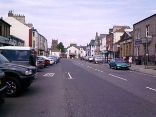 Kirkby Stephen is the kind of town I could live in. It has all the stores and amenities I prefer: grocers, a few restaurants, coffee shops, a co-op, library, post office, banks, etc., but no Starbucks and Marks & Spencer. An old-fashioned main street goes through the center of town, and residences pile up on either side behind the merchant streets. The larger stores are within driving distance.
Today’s weather was supposed to be another scorcher or a thunderstorm, neither of which materialize by the afternoon. The sky is flat white, the temps cooler with sunshine.
I spend the morning in my room at the hostel, doing all my laundry, naming all my photos, and processing which OS maps I can mail to Norman and Jean now that I’m done with them. I’ll be able to give them a good collection for their own walks.
I emerge for lunch and shopping around 12:30 and go to the Pink Geranium for my favorite kind of meal—a ploughman’s lunch. I buy a new, higher quality compass (at Michael’s recommendation) and go to the library in hopes of using the Internet. I meet Elaine and John there (no surprise!), but can’t get into my e-mail because my GoDaddy account doesn’t support the older Internet Explorer 5.5, which this library still uses. Sheesh. Another strikeout. And another reminder that the rest of the world doesn’t live and die by the latest technology the way we seem to in Seattle.
Three hours at the hostel dining room means I finally complete my scrapbook for the trip. I haven’t been collecting memento scraps since Inveraray, so it is easy to finish the last pages. I scribble some notes about my time in Inveraray, Jura, Torlundy, and the walk so far. The pages seem spare by comparison to the first half of the trip. I’ve done and consumed much less in the past month, yet I feel more full of the experiences I’ve had. Funny, that.


 I mail the scrapbook and my maps to Norman and Jean, then go for an amble south of town. I follow a foot path that John had told me about, and end up by the Eden River. It burbles quietly. Lots of river rock, overhanging trees, a gray cow grazing at the near bank then splashing across and away. I find a stone stamped “NEW”—perhaps an old brick facing that went astray and got eroded to nearly nothing.
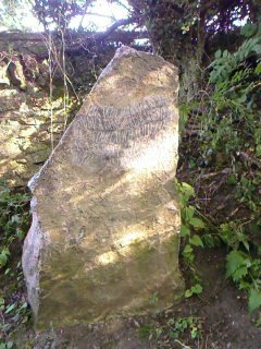
 By the entrance to the stream is a large boulder with a poem carved on it in wavy letters that made them look windblown: “The sky’s harsh crystal/ Wind a blade, trees stripped,/ Grass dull with cold. Life/ Is a kernel hidden/ In the stone of winter.” No signature except a block carving of a man with a scythe in tall grass.
Walking alone instead of with others, I find I pay more attention to the surroundings in order not to get lost. I also remind myself more often to take in the view. Walking with others, I may take in the view, but quite often I slip into “passenger” mode, mind switched off, just going along unless I’m in front and playing pathfinder.
I begin reading Natalie Goldberg again (Writing Down the Bones) after planning my route for the next two days. I haven’t been able to send this book away to London to lighten my load. She writes like a friend, a guide, a crazy person who shows me that it’s okay to use writing as a way out, or through, or over, or in, whichever path I need to take at the moment.
Her essay “No Hindrances” has a construction-worker friend saying that if he “did the dead center of what he’s supposed to be doing, it would be writing, ‘but building’s easier.’”
I ask myself that question—what is the dead center of what I’m supposed to be doing?
The answer is very clear. Stop writing for others. Downsize more. Resist getting caught up in the swirl of stuff and bills again. Travel more. Get a small place for six months. Write. Write. Write.
Three chestnut Arabians are grazing in a sheep field that I pass on my way home. Two of them have three knee-high white socks, the other has four. I sit on the wall. Two come over to graze nearby. I leave a while later to go in search of supper, and remember the special block print my long-time friend Dean sent me last Christmas. He had dedicated it to me because of its subject—a canal-walking draft horse that had its own mind, and did its work in its own way, regardless of what anyone else wanted him to do or be. As Dean watched me sell my home, release my horse, downsize my possessions, and then set off on this trip, he saw me as someone who follows her own path like that horse, Mike. His faith in me is both a tribute and an inspiration as I look ahead and wonder what comes next.
Trail miles: 12; actual miles walked: 12.5, plus a few miles of rambling on the rest day.
 Kirkby Stephen is the kind of town I could live in. It has all the stores and amenities I prefer: grocers, a few restaurants, coffee shops, a co-op, library, post office, banks, etc., but no Starbucks and Marks & Spencer. An old-fashioned main street goes through the center of town, and residences pile up on either side behind the merchant streets. The larger stores are within driving distance.
Today’s weather was supposed to be another scorcher or a thunderstorm, neither of which materialize by the afternoon. The sky is flat white, the temps cooler with sunshine.
I spend the morning in my room at the hostel, doing all my laundry, naming all my photos, and processing which OS maps I can mail to Norman and Jean now that I’m done with them. I’ll be able to give them a good collection for their own walks.
I emerge for lunch and shopping around 12:30 and go to the Pink Geranium for my favorite kind of meal—a ploughman’s lunch. I buy a new, higher quality compass (at Michael’s recommendation) and go to the library in hopes of using the Internet. I meet Elaine and John there (no surprise!), but can’t get into my e-mail because my GoDaddy account doesn’t support the older Internet Explorer 5.5, which this library still uses. Sheesh. Another strikeout. And another reminder that the rest of the world doesn’t live and die by the latest technology the way we seem to in Seattle.
Three hours at the hostel dining room means I finally complete my scrapbook for the trip. I haven’t been collecting memento scraps since Inveraray, so it is easy to finish the last pages. I scribble some notes about my time in Inveraray, Jura, Torlundy, and the walk so far. The pages seem spare by comparison to the first half of the trip. I’ve done and consumed much less in the past month, yet I feel more full of the experiences I’ve had. Funny, that.


 I mail the scrapbook and my maps to Norman and Jean, then go for an amble south of town. I follow a foot path that John had told me about, and end up by the Eden River. It burbles quietly. Lots of river rock, overhanging trees, a gray cow grazing at the near bank then splashing across and away. I find a stone stamped “NEW”—perhaps an old brick facing that went astray and got eroded to nearly nothing.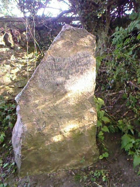
 By the entrance to the stream is a large boulder with a poem carved on it in wavy letters that made them look windblown: “The sky’s harsh crystal/ Wind a blade, trees stripped,/ Grass dull with cold. Life/ Is a kernel hidden/ In the stone of winter.” No signature except a block carving of a man with a scythe in tall grass.
Walking alone instead of with others, I find I pay more attention to the surroundings in order not to get lost. I also remind myself more often to take in the view. Walking with others, I may take in the view, but quite often I slip into “passenger” mode, mind switched off, just going along unless I’m in front and playing pathfinder.
I begin reading Natalie Goldberg again (Writing Down the Bones) after planning my route for the next two days. I haven’t been able to send this book away to London to lighten my load. She writes like a friend, a guide, a crazy person who shows me that it’s okay to use writing as a way out, or through, or over, or in, whichever path I need to take at the moment.
Her essay “No Hindrances” has a construction-worker friend saying that if he “did the dead center of what he’s supposed to be doing, it would be writing, ‘but building’s easier.’”
I ask myself that question—what is the dead center of what I’m supposed to be doing?
The answer is very clear. Stop writing for others. Downsize more. Resist getting caught up in the swirl of stuff and bills again. Travel more. Get a small place for six months. Write. Write. Write.
Three chestnut Arabians are grazing in a sheep field that I pass on my way home. Two of them have three knee-high white socks, the other has four. I sit on the wall. Two come over to graze nearby. I leave a while later to go in search of supper, and remember the special block print my long-time friend Dean sent me last Christmas. He had dedicated it to me because of its subject—a canal-walking draft horse that had its own mind, and did its work in its own way, regardless of what anyone else wanted him to do or be. As Dean watched me sell my home, release my horse, downsize my possessions, and then set off on this trip, he saw me as someone who follows her own path like that horse, Mike. His faith in me is both a tribute and an inspiration as I look ahead and wonder what comes next.
Trail miles: 12; actual miles walked: 12.5, plus a few miles of rambling on the rest day.