Monday, August 07, 2006

Farewell Coast, Hello (New?) York

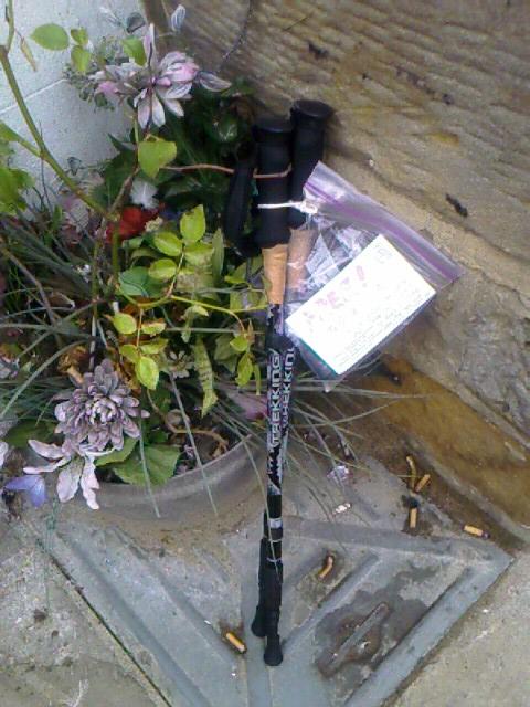
Halfway through the C2C, I decided I would leave my trusty trekking poles behind at Robin Hood’s Bay, propping them at the end of the road for someone to find for their own journey. I write a “FREE to Good Home” sign and attach it to the poles in a baggie and trundle down the slope for what is to be my last visit to the North Sea.


The village is very quiet at six thirty in the morning on a Monday. A few stalwarts are walking their dogs or taking beach photos. Milk has been delivered. Shops are closed. There’s no activity in front of the many B&Bs that bustled with people all weekend. I have the place to myself to explore afresh.


Seagulls caw and squawk and screech from every rooftop. They lift off and float down in clouds of white and gray and brown. The tide is very far out again. Rain clouds hover way out over the sea; a shaft or two of sunlight breaks like a spotlight onto the water before the cloud-mist overtakes it again.

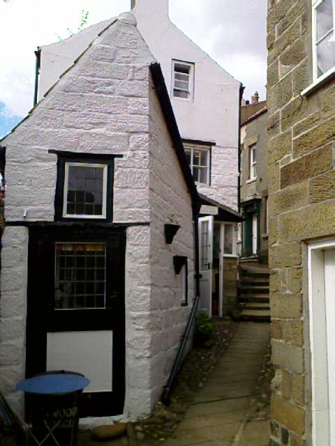

I find some lovely vantage points for views, secluded B&Bs down secluded walkways (including one cleverly signed as Upside Down Cottage), and amazingly teensy gardens at most of the cottages. These gardens are barely 8x6—big enough for a bench and a few pots, and for sharing a low fence with the neighbor’s 8x6 plot. Some also overlook the freshwater stream that flows through town to the sea. Another garden is a mere strip of paving that wraps from the front door to an alcove that’s big enough for a two-person bench. A waist-high fence and gate demarks the spot as private along the main thoroughfare of the village.

I walk home in a misty drizzle that is enough to wet my hair and clothes but that dries quickly while I pack in the room. In my last rite of ending the C2C, I remove the Sherpa Van luggage tag from my bag; no more helpers to haul my pack for me. After mailing my last batch of postcards, I intend to bus to Scarborough for a train to York.

I sit at breakfast writing all this and hear radio reports that bombs are still falling in Lebanon. The contrast is jarring.

Rather than bus to Scarborough, I accept a ride with my fellow B&B’ers Jackie and Barry, from Lincolnshire, about 100 miles south of Robin Hood’s Bay. I said no to their offer at first—my habit of self-sufficiency—and then accepted it with gratitude. No one offers something unless they want a yes, so I’m learning to say yes myself, to graciously accept kindnesses that come my way.

Jackie and Barry visit Robin Hood’s Bay and its area many times a year. They especially like to come during midweek off-season, when it’s quiet. They take me to Scarborough on a scenic route through an old estate that’s now a boarding school, through Fylingdales, around Cloughton, then along the seaside route of Scarborough, which, surprisingly, has the emaciated remains of a substantial 12th- to 14th-century castle that overlooked the harbor.

Scarborough today has a hotel row on the cliffs like Sandown on Wight, and rapidly devolves into a bay that’s fronted with arcades, food stalls, casinos, rock candy booths, entertainment venues, and so on. Lots of flashing marquis lights and bright colors and oversized plastic mascots beckoning tourists in to spend endless time and endless money. It’s like a small-scale blend of Coney Island, Las Vegas, a traveling carnival, and country fairgrounds sticky with cotton candy.

I take the 10:45 train to York. About a week is left of the trip now. I can feel it winding down, and I feel sad about its end, and a little scared of how I’ll handle the next steps. They seem so clear to follow on the map, and then get hazy in the middle distance. Yet I know now that, just as with every step on the C2C, my life is guided with love and adventure, and I’ll find the wayposts as I need them.

The train is very full today; for the first time on the trip, I’m glad to be in a first class seat. It’s quite a contrast, this train is, to the little diesel I took to Pickering. High speed. Quieter. Smoother. Toilets on board. No way to hang out a window, though. Too bad.

The trip to York is uneventful except for the snafu of a family of three who sit at the table across the aisle. They live somewhere between York and Scarborough and were supposed to be heading south to York but got on the northbound Scarborough train by mistake. As we pull up to our first stop—their home town—the husband says, “We’ve been gone an hour and we’re back where we started!” They have a good laugh. “It’s a good day for a train ride, anyway,” he concludes. Indeed it is: sunny and lots of countryside to look at.

The youth hostel in York is about one and half miles from the rail station. Check-in is easy, and the facility is quite nice. Big. Lots of amenities. And I’m locked out of my room only from 10 to 1 for cleaning; other hostels are often closed all day. I’m here for five nights, and I intend to park myself at the hostel lounge to catch up on my journaling and prepare as many blog entries as I can. I find these take time to write, and I want to have as much done as possible before I head back to the US, where I’ll finish them up.

I had spent several days in York on a trip in the mid-80s and know it’s a good place to use as a base. This time, I have less desire to tour the city than to just live here for a while.

I liked York the last time I was here. I’m not sure I like it now, though. It seems a lot more commercialized than before. Big-name stores, and tons of shops everywhere—shops, shops, shops. I don’t remember it being that way then, but maybe it was.

I walk into town and find the Minster under partial scaffolding—again (do cathedral renovations and cleanings ever get done?). Micklegate Bar (one of the five gated entrances to this medieval walled city) has been converted from a lovely artist’s studio of 20 years ago to a cheesy tourist attraction full of cheesy 3D tableaus of grimy mannequin men in a grimy prison, cheesy chopped-off heads dangling on staffs (they used to do that for real from this gate), a cheesy gift shop, and the cheesy chance to have your picture taken as if you’ve been beheaded. I wonder if the bar’s artist from 20 years ago, Brian Cotterill, is alive, let alone still living in York. I still have the beautiful chalk drawing of the Minster that he gave me.
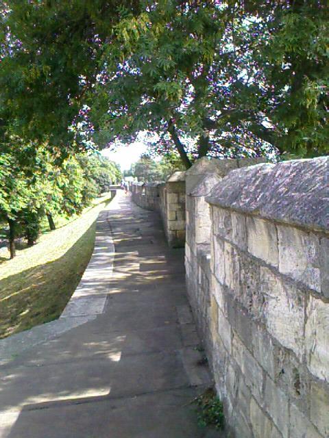


I walk the whole wall walk today, all two miles of it. I hadn’t done that the last time I was here. Part of the walk is no longer walled, but the city has embedded brass medallions in the sidewalks to show the original path. I grab a wall-walking guide and have fun picturing what the missing parts once looked like. The walk offers some lovely elevated views of the Minster, the city, and its environs. Funny to think that this town was once surrounded by fields to the horizon, instead of M roads and buildings.

At the south side, a peculiar motorized vehicle is crawling up and down an embankment, spewing grass in its wake. It’s got four independently moving wheels, a fine sense of balance, and an uncanny ability to assess its environment. Like some lumbering yellow metal turtle, it backs up and sidesteps, revolves a quarter turn, crawls down hill, pauses at a knoll to deliberate its next move, then revolves again and lurches across the hill.

I look around and finally spot the real mind behind the machine: a man standing in the shadow of the wall and pushing levers on a remote control box. Several men approaching on the wall also stop to watch the Spyder (so it’s called), taking photos and exclaiming, “That’s exactly what I need at home!”

In some parts of the walk, placards give interesting detail about a particular spot, such as the building where explosives had been stored and that went up in flames, or the building that looks like a brick igloo, where they used to store ice.

One of the bars (gates) has an original portcullis, that grid of wooden gate you always see in movies dropping down to keep marauders out of a city. It’s stored way up high in a recessed area, but its thick wood, and that of the doors that once closed up to it, are remarkable in their age.

A very non-medieval barrage of breeps and bings emanates from another stone bar. Flickering, high-tech flash of blue light reflects off the interior walls, as if a television were on in a darkened room. Inside, a band of tourists encircles a multimedia video game projected onto a table.

It’s a wall-walk race. Each quadrant of the table shows a fast-forward video of the wall walk, interspersed with stops at various locations for a pop quiz. If you answer the question correctly about where you are, you get to speed along. The one to get around the wall the fastest wins. I do pretty well on my game (237 seconds), but only because I had read the brochure and previewed some of the questions by looking over people’s shoulders before I played.

Sunday, August 06, 2006

Beach Bum at Robin Hood’s Bay

I had planned to stay an extra day at Robin Hood’s Bay, and am glad I did. I want to relish the completion of the Coast to Coast walk. Most of my friends left the day after they arrived. Michael and David headed back within hours of finishing on that rainy Wednesday...sopping and singing and changing clothes in the back of the Sherpa van that came to return them to Richmond for the drive home.

The morning is easy. Sleep in ’til 7:30, eat breakfast at 8, say goodbye to Marv, nap again ’til 10. Walk into town and buy postcards and a replacement shirt for the two I’ll be tossing soon. They got seriously faded in bands across the shoulders and the front from sweat and the backpack and repeated washings these past two weeks.

I wander around a lot today. My feet don’t seem to want to stay still after all that walking. They also don’t want to be in shoes, so I get to feel the sand and asphalt and stones of Robin Hood’s Bay and its village a lot of the day.


I buy a strawberry ice cream from the on-the-beach ice cream van, meander the labyrinth of skinny side streets and stone steps, sit on the slipway watching beach goers.

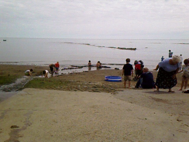
The day is another hot one, and people are out with beach shovels and pails, plastic dump trucks, romping dogs, inflatable rafts, plastic fish nets on 4' bamboo poles in pink, blue, green, yellow. Up a hill and around the corner from the Maritime Museum, some kind resident has propped a whole collection of these colored fish nets for free use—quiet competition to the shops at the top of the hill that sell them for a few pounds apiece.


Families and children are digging sand, making walls against the tide that overruns them as quickly as they’re built. People push strollers along the packed sand, up and over cobbles on the slipway, through rivulets of water running to the sea from the town’s stream. There is a strong smell of sea today: a muggy, seaweedy smell. A sweet fragrance of pipe tobacco passes by—he is the only pipe smoker I’ve come across this trip.

The tide is much higher than it was yesterday at 3:30 when I got in. I am getting eaten by beach flies where I sit, so I decide on a water walk.

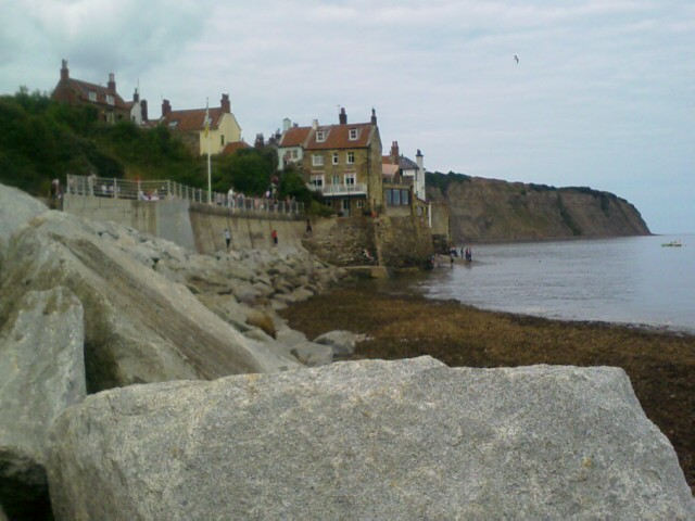
This beach and how people enjoy it is very different from Wight, Cornwall, St Bees. There are no miles of hotels, sand, and beach houses like at Wight; no rugged boulders and crashing waves like at Cornwall; no evenly spaced jetties and water-level boardwalk like at St Bees. Here is a towering seawall built to bolster the village from dropping into the sea. Beach that disappears rapidly with the tide; a main street that slides directly to the water; boardwalks along the top of the seawalls; concrete ramps and steps that lead down to the sand at low tide and are barricaded with chains at high tide.

A boy and his dad have made a sand boat at the base of the northern seawall. The flags are fish nets stuck up at each side. The boy sits on a towel in the boat, “Because,” his mother explains to me, “he hates to sit in the sand.” They soon have to abandon ship with the swamping tide.

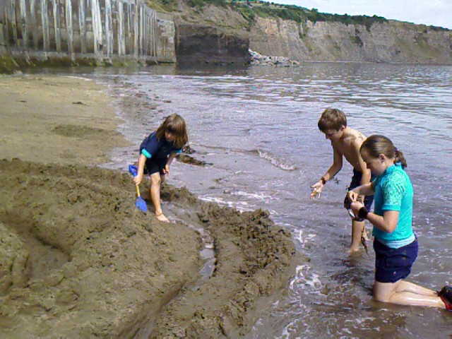
Waters overtake another deserted sand fort, and farther on three children are desperately trying the protect the stronghold they’ve abutted to the seawall.

I admire their work.

“My brother likes building castles,” says a girl of the trio. She’s the eldest, about 11.

“How long has it taken you?”

“All day!” proclaims the boy, whose citadel this is. “We’ve been here since eight in the morning!”

It is about noon now.

“This is the castle.” The girl hikes over the mounds and points to a pile of sand the size of a grapefruit that’s molded against the wall. The castle keep. They’ve surrounded it with semicircles of ditches and high walls—the builders of Old Sarum Mound in Salisbury couldn’t have done it better.

“This one’s called The Flying Cape Castle,” says the boy as he and his sisters fortify the third ring of sand against the incoming sea. Their father comes by and we chat a bit. They’re from Suffolk, Cambridge area.

The girl chimes in, “We’ve been coming here for holiday every year since I was born.”

The father laughs: “I’ve been coming here every year since I was born.” He points to his kids. “They’ve been at this since before breakfast. I came to find them for lunch.”

The tide has come in enough that my way back to the slipway is now under water along the seawall. I say goodbye and slosh back to town to find a bit of lunch myself.

Not in the mood for a pub, I retrace the line of people walking around with fish-and-chips containers and end up at a take-out up one of the village’s angling side streets. The shop is so tiny and narrow that patrons form a U-turn queue through its single door, entering to place an order and leaving with their hands full of hot goods. “’Scuse me, ’scuse me, oh I’m so sorry,” as we all bump shoulders to make way for each other while advancing to our next place in line.

The servers are sassy twenty-somethings, all men, and loving their popularity at the busy lunch hour. I drop a tip into their “Staff Beer Fund” as recompense for the photo I take, and one of them says, “Thank you miss. For that, you get something extra.” He lays one extra chip speared with a wooden fork onto my meal box. “See that, folks?” he says to the rest of the patrons. “Generosity never goes unrewarded.”


Blowing the heat off the fish and chips, I take a bench at the upper boardwalk for more people watching from the overview point. A fellow next to me plays Sudoku. The sun keeps coming and going, brilliant and hot when it’s not behind clouds, which is where it’s been most of the day.

I visit the Maritime Museum at see interesting displays of how tides work (a working model of the moon, the earth spinning, and a diorama of the sea rising and falling along the shore of Robin Hood’s Bay).

The Morris dancers are still here, so I catch a more of their show and mostly hang around the village for the rest of the day. I am feeling like a tourist again, only different. More able to sit and just be here. That is enough for now.

Saturday, August 05, 2006

C2C Day 19, Robin Hood’s Bay (Mile 192)—The End of the Road

I am ending the C2C as I began it—on a day of solitary walking.

I feel tears welling up as I talk with Judith about this being my last day of the walk. Grief that it’s almost over. Happiness at what I’ve done. Some relief, too.

Near nine-thirty, I’m just getting ready to leave Intake Farm, and I receive a text from David and Michael wishing me luck on my last push to Robin Hood’s Bay. Funny, by now this doesn’t feel like a push. I’m just walking 12 miles to RHB from Littlebeck today.


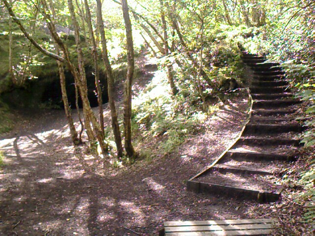
The path out starts with a lovely, long, cool walk through May Beck and its forest—the “valley somewhere over there, lots of twists and turns along the river” that my guide from yesterday had told me about. This forest trail is more lovely to me than any I’ve walked in Olympia. No wonder someone spent months (years?) carving out The Hermitage from a boulder in 1790.


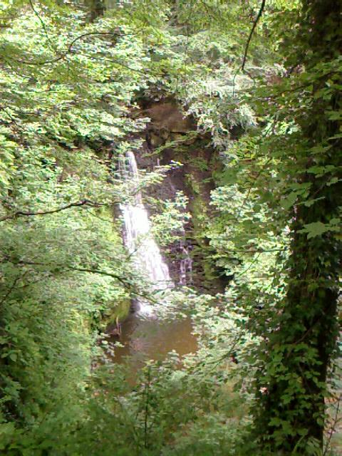
A waterfall, Falling Foss, near Midge Hall (once converted to a museum but now boarded up and derelict), seems to appear out of nowhere around a bend, and I understand why Wainright dubs this area one of “bewitching beauty.”

I feel strong and surefooted as I tread over rocks and stepping stones and tree roots. This is different from my gingerly walking across similar footing at the beginning of the C2C. I am gaining a new kind of physical balance, which pleases me.


The southerly forest route gets left behind for a sharp turn to the north, which meets up with a north-easterly path across moors, roads, and more moors before it jogs around the coastline for the last three miles.

I stand on Greystone Hills (at mile 184) and look back on how far I’ve come in just the past two days, let alone the past 18. I can feel tears sting again. They are a mix of happiness and sadness—happiness over what I’ve accomplished, what I’ve learned, whom I’ve met, how far I’ve come, how much more is yet to come—this journey never ends. And sadness that this part of the journey is almost over.

I am also sorry that I packed my last OS map and put sole (pardon the pun) trust in the Footprint map today. The path looked so easy, but it has been sometimes tricky to follow, especially over Greystone Hills, a rolling moor where promised signposts are difficult to spot (far apart and not always visible until I’d crested a rise) and where several paths crisscross from boots, sheep, and natural runoff areas.

The Footprint map just doesn’t have the necessary detail over this kind of terrain, especially when a trail fades across a sheep pasture. Having passed successfully, if somewhat erratically, over Greystone Hills, for instance, I stand next to a stile and beside the only fingerpost in sight to reconnoiter. The post points to where I’ve just come from (a good sign in that respect), but not also to where I should go next.

The field ahead of me has grass cropped short as a new marine’s hair, leaving no tracks. The map is little help—I’m correctly at Normanby Hill Top by all reckoning, but the map doesn’t offer additional visual details such as boundary lines and stone walls. No one is around to ask but the sheep, and I’m not yet proficient in the language of Baah. So I just forge ahead in the general, gut-feeling compass direction and manage to find my way to something that resembles a track.

I feel more sure of my decision when I come upon a tight, hedgerow-lined dirt trail that is still muddy. Bootprints are clearly visible (yay!), and I wonder if any of them belong to friends who have passed ahead of me this week. I swear I see John and Elaine’s bootsoles at one point. This little overgrown lane is full of wildflowers and butterflies. I hang around nearly half an hour watching and trying to photograph the flighty things.

Quarter after one, I sit down to a bacon-and-cheese-melt baguette and orange-cranberry J2O at the Hare & Hounds Inn in High Hawsker. I am cooling down from a sweaty and tiring walk, easing my feet from the now-familiar ache on the sole of my heels, and wiping off miniscule hitchhiking bugs that are crawling all over me and my juice glass. Not sure what’s different about where I’ve been today—I haven’t encountered these nuisance bugs until now. Must be the nearness to the sea.


I leave High Hawsker a little after two for the last leg of the walk, three miles of which follows the cliffs of the North Sea, just as the beginning followed the St Bees Head coast. The long-range view is turning murky, the kind where the sea melts into sky at the horizon.

Along the bluffs, I begin passing many people going the other way on the coastal trail—no packs, so they’re only out for day walk. Probably trekking from the caravan park outside Hawsker to RHB for the day, or coming back from the same. One man is a dead ringer for Rowan Atkinson/Mr. Bean.


Breezes cool my skin. I hear only the shush of waves, a sea-silence anytime I’m away from the cliff, the scream of distant gulls. Occasionally the smell of cow patties wafts over from the fields at my right.

I pause on a cliff to take a photo of what I think is RHB way off in the distance, and am suddenly greeted by a grinning, scruffy, shirtless man wearing a backpack and camera and a bandana on his head, holding up his hand in a high-five—it’s Aussie John! He and Elaine are staying in Whitby a few miles back; he’d walked to RHB to find more postcards with Wendy the Sheep, and was hoping he might see me there. He’d also just run into Marv five minutes before—oh, yay, I may have a chance to commemorate the walk’s closure with a friend, after all.

We take photos of each other, say goodbye again (rats!), and I walk into Robin Hood’s Bay, which, John has happily informed me, is actually just around the bend (and just over my shoulder in this photo).

It is also crowded. Having spent the past 19 days meeting barely anyone, I am overwhelmed by the number of people going down RHB’s hill.

It’s steep, a 33% grade straight down to the sea, and passes through an old village that’s riddled with winding alleys and angled side roads and itty-bitty peekaboo gardens. I am at the top of the village, aiming for the sea, and getting blocked by doddering old folks who walk two abreast and somehow take up the space of four, by families whose children and strollers spread like a Roman phalanx across the sidewalk, by people walking dogs that zig and zag after every new scent, by folks streaming out of car parks and side streets. I had no idea that this place is such a draw for visitors.

I weave around them all for the first 200 yards, a woman on a mission, a woman who needs clear space in front of her, dammit, before I catch myself rushing the moment. I slow down to take more in. To savor these last quarter mile of the walk.

From the bottom of the hill comes a steady drumbeat—the kind of drumbeat that Native American singers use. I recall the Native American buskers in London in their feathered and leathered regalia. My heart sinks. Surely not here. Please don’t let it be some cheesy performance here, at the end of this celebrated walk.

I round the last corner in a flood of relief—no befeathered, befringed Native American Indian mockups, but a troupe of traditional Morris dancers dressed in white shirts and trousers, bells around their knees, beribboned hats on their heads, dancing like the ensemble in Chitty Chitty Bang Bang who sing “Me Old Bamboo.” Their straw hats are decorated with wheat braids in many shapes—wreaths, ropes, baskets, each with a colorful ribbon on it.

They are at the very bottom of the hill, at the entrance to the sea slip. I decide the water ritual can wait and hang around to watch the troupe—all men except for one fiddle player—do a couple of dances. Their bells jingle cheerily as they stomp and spin and kick to the beat of drum, horn, and fiddle, and my toes tap to the rhythm. All discomfort and hurry is forgotten. I scan for a glimpse of Marv somewhere in the crowd, but do not spot him.


Finally I turn to go to the sea. I fish out the red sandstone I’ve carried for the last 190+ miles. I strip off my boots and socks and wade into the cold water. The tide is in; the sand is hardpan beneath my feet. I ask for a photo from another walker—one of a group of ten (mostly 20-something boys) who had walked the path in an astonishing seven days. Ten is really pushing it. They are exhausted, exhilarated, blistered, and flinging themselves backwards into the water with the delight of being done.

I wander the tide line, happy to be barefoot and to feel the cold water around my ankles and calves. Two men play football in the sea with their re-homed German shepherd. The dog loves to chase the ball, but hates to drop it. Hisssssshhh goes the ball as it yields to the dog’s jaws, and hoouuuuhghhgh it goes again as it refills when he releases pressure. “He gets a new ball every two weeks” laughs one of his stewards.

I still have the stone in my hand. It’s been like a talisman these past weeks. I toy with the idea of keeping it, of taking it back to the US. I collect things like that. Special rocks that remind me of where I’ve been. Sometimes I keep them a long time. Sometimes I leave them at other special places I visit or live at.

No. Not this one. I need to let this one go. I need to let it go here, as a final, grateful gesture of my achievement. All that it has stood for is stored in my heart, and I need no physical reminder.

I wade to a spot that feels right and pitch the stone side-arm into the sea. It plunks unceremoniously into the water.

There. That’s it. It’s over. Who knows what the North Sea will do to that rock in the years ahead, rolling it along the seafloor, eroding it more, pushing it onto the beach. Perhaps it will decorate a child’s sand castle some day. Perhaps it will crack open a shellfish for a seagull. Or perhaps it will accompany another C2C’er on his own personal trek back to the opposite side of this island known as Britain.


The cold sea has practically numbed my feet, so I go in search of a beer at the Wainwright Bar, the last pub at the very end of the road, standing beside the cobbled sea slip and sporting an official plaque marking THE END of the 192-mile walk and illustrating the elevation changes we covered. (Official mile counts vary from 190 to 192, but it certainly can get longer with detours, alternative routes, and miles added for getting to and from off-trail lodgings.)

In that cramped little pub, I meet the entire group of ten who had walked the trail in seven days. We all order beers and compare stories. I have traveled 19 days and had one day of pouring rain; they have traveled seven days and had five days of pouring rain. Such is the fickleness of timing and British weather.

I would never wish to do that walk in seven days, but their gusto for the sheer challenge of it is entertaining. They bemoan the wet camping, the piercingly aching knees, the lunches taken without break on the road. They boast of doing the Keswick (Kezzick) to Barrow walk (40 miles, mostly roads) in 12.5 hours, and of wanting to do the Lyke Wake Walk (a race of 40 miles in 24 hrs, trail walking with hills) next. One of the women is in her fifties and, judging by her effusive delight over these challenges, is clearly better equipped than I to meet them.

I sign the C2C guest book that is kept at this pub, finding entries from Michael and David (“I did it!”) and from John and Elaine, who have written “Hello Audrey, Jenny and Len” next to their entry. I write “Hello—I made it!” back to them, then find a clean line to sign my own way into C2C history.

Having finished my beer, it’s time to find my B&B, Fern Leigh, which is somewhere past the top of RHB hill. I reject the idea of putting my boots back on, and instead walk barefoot up the half mile long road. The miles and miles of walking, even in boots, have toughened my feet so much that the hard, sharp asphalt and warm, smooth cobblestones and cool, prickly grass actually feel good instead of ouchy on my soles.

I keep trying to spot Marv among the many people in town, and am disappointed to miss him. He could be anywhere, staying at any of the dozens of hotels and lodgings that line the roads here. The prospect of eating dinner alone tonight depresses me.

I walk into the cool, tiled anteroom of Fern Leigh and I am pleasantly surprised when the proprietress informs me that Marv is staying at the same B&B, just down the hall! My depression lifts, and we plan for dinner together.

We end up at The Dolphin pub, upstairs at a table by the piano—literally by the piano, where we’re practically eating off of the covered keyboard. Nearby is an old forgetful jukebox that will play any song you don’t select for 20p. I order a tuna slab on a bed of basil noodles with fruit and tomato salsa. There’s so much food that I can’t eat it all.

After dinner, we briefly watch more of the Morris dancers, who have come back for an evening performance, then wander around window shopping and admiring the architecture of this quaint little village.

I am to bed by 9:30, very tired, and very glad that I had planned two nights here at RHB, instead of just one.

Trail miles: 12; actual miles walked: 13.5